The Caspian Sea is located between Asia and Europe. This is the largest salt sea-lake, located on the territory of Kazakhstan, Russia, Azerbaijan, Iran and Turkmenistan. Currently, its level is 28 meters below the level of the World Ocean. The depth of the Caspian Sea is quite large. The area of the reservoir is 371 thousand square kilometers.
Story
About five million years ago, the sea divided into small bodies of water, including the Black and Caspian seas. After these events they united and separated. About two million years ago, the Caspian Lake was cut off from the World Ocean. This period is considered the beginning of its formation. Throughout history, the reservoir has changed its contours several times, and the depth of the Caspian Sea has also changed.
Now the Caspian is the largest inland body of water, containing about 44% of the planet’s lake waters. Despite the changes taking place, the depth of the Caspian Sea did not change very much.
Once it was called Khvalian and Khazar, and the tribes of horse breeders gave it another name - Caspian. This is the name of the tribe living on the southwestern shore of the reservoir. In total, during its existence the lake had more than seventy names, here are some of them:
- Abeskunskoe.
- Derbent.
- Saraiskoe.
- Xihai.
- Dzhurdzhanskoe.
- Hyrcanian.

Depth and relief
The relief and features of the hydrological regime divide the sea-lake into northern, middle and southern parts. Over the entire area of the Caspian Sea, the depth is on average 180-200 m, but the relief in different parts is different.
The northern part of the reservoir is shallow. Here the depth of the Caspian Sea-lake is approximately 25 meters. In the middle part of the Caspian there are very deep depressions, continental slopes, and shelves. Here the average depth is 192 meters, and in the Derbent depression - about 788 meters.
The greatest depth of the Caspian Sea is in the South Caspian depression (1025 meters). Its bottom is flat, and in the northern part of the depression there are several ridges. It is here that the maximum depth of the Caspian Sea is noted.

Coastline Features
Its length is seven thousand kilometers. The northern part of the coastline is lowland, there are mountains on the south and west, and hills on the east. The spurs of Elbrus and the Caucasus Mountains approach the shores of the sea.
The Caspian has large bays: Kazakh, Kizlyar, Mangyshlak, Kara-Bogaz-Gol, Krasnovodsk.
If you go on a cruise from north to south, the length of the route will be 1200 kilometers. In this direction, the reservoir has an elongated shape, and from west to east the width of the sea is different. At its narrowest point it is 195 kilometers, and at its widest it is 435 kilometers. The average width of the reservoir is 315 km.
The sea has several peninsulas: Mangyshlak, Buzachi, Miankale and others. There are also several islands here. The largest are Chygyl, Kur-Dashi, Gum, Dash, and Tyuleni Islands.

Pond food
About one hundred and thirty rivers flow into the Caspian Sea. Most of them flow in the north and west. The main river flowing into the sea is the Volga. Approximately ninety percent of the volume of runoff comes from three large rivers: the Volga (80%), Kura (6%) and Ural (5%). Five percent are from Terek, Sulak and Samur, and the remaining four are brought by small rivers and streams of Iran.
Resources of the Caspian Sea
The reservoir has amazing beauty, a variety of ecosystems and a rich supply of natural resources. When there are frosts in its northern part, magnolias and apricots bloom in the south.
Relict flora and fauna have been preserved in the Caspian Sea, including the largest school of sturgeon fish. As it evolves marine flora changed more than once, adapting to salinization and desalination. As a result, these waters became rich in freshwater species, but few in marine species.
After the Volga-Don Canal was built, new species of algae appeared in the reservoir, which were previously found in the Black and Seas of Azov. Now in the Caspian Sea there are 854 species of animals, of which 79 are vertebrates, and over 500 species of plants. This unique sea-lake produces up to 80% of the catch of all sturgeon in the world and approximately 95% of the black caviar production.
Five species of sturgeon are found in the Caspian Sea: stellate sturgeon, thorn, sterlet, beluga and sturgeon. Beluga is the largest representative of the species. Its weight can reach a ton, and its length can be five meters. In addition to sturgeon, herring, salmon, kutum, roach, asp and other types of fish are caught in the sea.
Of the mammals in the Caspian Sea, only the local seal is found, which is not found in other bodies of water in the world. It is considered the smallest on the planet. Its weight is about a hundred kilograms, and its length is 160 centimeters. The Caspian region is a major route for bird migration between Asia, the Middle East and Europe. Every year, approximately 12 million birds fly over the sea during migration (south in spring and north in autumn). In addition, another 5 million remain in these places for the winter.

The greatest wealth of the Caspian Sea is its huge reserves of oil and gas. Geological exploration in the region has discovered large deposits of these minerals. Their potential puts local reserves in second place in the world after
Caspian Sea short description drainless salt lake of Eurasia and the largest lake on the planet is described in this article. A message about the Caspian Sea will help you prepare for classes.
Caspian Sea: report
This water body is located at the geographical junction of Europe and Asia. The water level is 28 m below the level of the World Ocean. Over its long history, the Caspian Sea has “changed” more than 70 names. And it received its modern name from the ancient Caspian tribe, who were engaged in horse breeding and settled along the southwestern shore of the lake.
Salinity of the Caspian Sea not constant: near the mouth of the Volga River it is 0.05%, and in the southeast the figure increases to 13%. The area of the water body today is about 371,000 km2, the maximum depth of the Caspian Sea is 1025 m.
Features of the Caspian Sea
Scientists have conditionally divided the lake-sea into 3 natural zones:
- Northern
- Average
- Southern
Each of them has a different depth and composition of water. For example, the smallest part is Northern. The full-flowing Volga River flows here, so the salinity here is the lowest. And the southern part is the deepest, and, accordingly, salty.
The Caspian Sea was formed more than 10 million years ago. It can be called part of the ancient Tethys superocean, which once lay between the African, Indian and Eurasian continental plates. Its long history is also evidenced by the nature of the bottom and geological coastal deposits. The length of the coastline is 6500 - 6700 km, and including the islands up to 7000 km.
The shores of the Caspian Sea are predominantly smooth and low-lying. The northern part of the coastline is indented by islands and channels of the Ural and Volga deltas. The shore is swampy and low, covered with thickets. The eastern coast is characterized by limestone coasts that are adjacent to deserts and semi-deserts. The west and east coasts have winding coastlines.
Where does the Caspian Sea flow?
Since the Caspian Sea is an endorheic body of water, it is logical that it does not flow anywhere. But 130 rivers flow into it. The largest of them are Terek, Volga, Emba, Ural, Kura, Atrek, Samur.
Climate of the Caspian Sea
In the northern part of the sea the climate is continental, in the middle part it is temperate and in the southern part it is subtropical. In winter, the average temperature ranges from – 8 … – 10 (northern part) to +8 … + 10 (southern part). Summer average temperatures range from +24 (northern part) to +27 (southern part). The maximum temperature recorded on the east coast was 44 degrees.
Animal and plant life
The fauna is diverse and includes 1809 species. The sea is home to 415 invertebrates and 101 species of fish. It contains most of the world's reserves of pike perch, sturgeon, roach, and carp. In the Caspian Sea there are carp, mullet, bream, sprat, perch, kutum, pike, and also such large mammal like the Caspian seal.
The flora is represented by 728 species. The sea is dominated by diatoms, brown algae, red algae, blue-green algae, chara algae, ruppium and zoster.
The importance of the Caspian Sea
On its territory there are many gas and oil reserves, the fields of which are at the development stage. Scientists have calculated that oil resources amount to 10 billion tons, and gas condensate - 20 billion tons. The first oil well was drilled in 1820 on the Absheron shelf. Limestone, sand, salt, stone, and clay are also mined on its shelf.
In addition, the Caspian Sea is popular among tourists. Modern resort areas are being created on its banks; mineral waters and mud contribute to the development of health complexes and sanatoriums. The most famous resorts are Amburan, Nardaran, Zagulba, Bilgakh.
Environmental problems of the Caspian Sea
Sea waters are polluted as a result of the extraction and transportation of gas and oil on the shelf. Pollutants also come from the rivers that flow into it. Poaching of sturgeon caviar has led to a decrease in the number of these fish.
We hope that the report on the Caspian Sea helped you prepare for the lesson. You can supplement your essay about the Caspian Sea using the comment form below.
The Caspian Sea is the largest enclosed body of water on planet Earth, located on the continent of Eurasia - in the border territory of the states of Russia, Kazakhstan, Turkmenistan, Iran and Azerbaijan. In fact, it is a giant lake left after the disappearance of the ancient Tethys Ocean. Nevertheless, there is every reason to consider it as an independent sea (this is indicated by its salinity, large area and considerable depth, a bottom made of oceanic crust and other signs). In terms of maximum depth, it is the third among closed reservoirs - after lakes Baikal and Tanganyika. In the northern part of the Caspian Sea (several kilometers from the northern shore - parallel to it) there is a geographical border between Europe and Asia.
Toponymy
- Other names: throughout the history of mankind, the Caspian Sea has had about 70 different names among different peoples. The most famous of them: Khvalynskoye or Khvalisskoye (took place during the Ancient Rus', arose from the name of the people praises, who lived in the Northern Caspian region and traded with the Russians), Girkanskoe or Djurdzhanskoe (derived from alternative names for the city of Gorgan, located in Iran), Khazarskoe, Abeskunskoe (after the name of the island and city in the Kura delta - now flooded), Saraiskoe, Derbentskoe, Sikhai .
- Origin of name: according to one hypothesis, its modern and most ancient name, The Caspian Sea received from a tribe of nomadic horse breeders Caspian Sea, who lived in the 1st millennium BC on the southwestern coast.
Morphometry
- Catchment area: 3,626,000 km².
- Mirror area: 371,000 km².
- Coastline length: 7,000 km.
- Volume: 78,200 km³.
- Average depth: 208 m.
- Maximum depth: 1,025 m.
Hydrology
- Availability of permanent flow: no, drainless.
- Tributaries:, Ural, Emba, Atrek, Gorgan, Heraz, Sefidrud, Astarchay, Kura, Pirsagat, Kusarchay, Samur, Rubas, Darvagchay, Ulluchay, Shuraozen, Sulak, Terek, Kuma.
- Bottom: very diverse. At shallow depths, sandy soil with an admixture of shells is common; in deep-sea areas, it is silty. In the coastal strip there may be pebble and rocky places (especially where mountain ranges adjoin the sea). In the estuarine areas, the underwater soil consists of river sediments. The Kara-Bogaz-Gol Bay is notable for the fact that its bottom is a thick layer of mineral salts.
Chemical composition
- Water: salty.
- Salinity: 13 g/l.
- Transparency: 15 m.
Geography

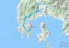
Rice. 1. Map of the Caspian Sea basin.
- Coordinates: 41°59′02″ n. latitude, 51°03′52″ e. d.
- Height above sea level:-28 m.
- Coastal landscape: Due to the fact that the coastline of the Caspian Sea is very long, and it itself is located in different geographical zones, the coastal landscape is diverse. In the northern part of the reservoir, the banks are low, swampy, and in the deltas of large rivers, they are cut by numerous channels. The eastern shores are mostly limestone - desert or semi-desert. The western and southern shores are adjacent to mountain ranges. The greatest ruggedness of the coastline is observed in the west, in the area of the Absheron Peninsula, and also in the east, in the area of the Kazakh and Kara-Bogaz-Gol bays.
- Settlements on the banks:
- Russia: Astrakhan, Derbent, Kaspiysk, Makhachkala, Olya.
- Kazakhstan: Aktau, Atyrau, Kuryk, Sogandyk, Bautino.
- Turkmenistan: Ekerem, Karabogaz, Turkmenbashi, Khazar.
- Iran: Astara, Balboser, Bender-Torkemen, Bender-Anzeli, Neka, Chalus.
- Azerbaijan: Alyat, Astara, Baku, Dubendi, Lankaran, Sangachali, Sumgayit.
Interactive map
Ecology
The ecological situation in the Caspian Sea is far from ideal. Almost all large rivers flowing into it are polluted by wastewater from industrial enterprises located upstream. This could not but affect the presence of pollutants in the waters and bottom sediments of the Caspian Sea - over the past half century, their concentration has increased significantly, and the content of some heavy metals has already exceeded permissible standards.
In addition, the waters of the Caspian Sea are constantly polluted by domestic wastewater from coastal cities, as well as during oil production on the continental shelf, and during its transportation.
Fishing on the Caspian Sea
- Types of fish:
- Artificial settlement: not all of the above fish species in the Caspian Sea are native. About 4 dozen species arrived by accident (for example, through canals from the basins of the Black and Baltic Seas), or were intentionally populated by humans. As an example, it is worth citing mullets. Three Black Sea species of these fish - mullet, sharpnose and singil - were released in the first half of the 20th century. The mullet did not take root, but the sharpnose and the singil successfully acclimatized, and by now have settled virtually throughout the entire Caspian waters, forming several commercial herds. At the same time, the fish fatten up faster than in the Black Sea and reach larger sizes. In the second half of the last century (starting from 1962), attempts were also made to introduce such Far Eastern salmon fish as pink salmon and chum salmon into the Caspian Sea. In total, several billion fry of these fish were released into the sea over the course of 5 years. Pink salmon did not survive in the new habitat, chum salmon, on the contrary, successfully took root and even began to enter the rivers flowing into the sea to spawn. However, it was unable to reproduce in sufficient quantities and gradually disappeared. There are still no favorable conditions for its full natural reproduction (there are very few places where spawning and development of fry could successfully occur). To provide them, river reclamation is necessary, otherwise, without human help (artificial collection of eggs and their incubation), the fish will not be able to maintain their numbers.


Fishing spots
In fact, fishing is possible anywhere on the Caspian Sea coast, which can be reached by land or water. What types of fish will be caught depends on local conditions, but to a greater extent on whether the rivers flow here. As a rule, in places where estuaries and deltas are located (especially large watercourses), the water in the sea is greatly desalinated, so freshwater fish (carp, catfish, bream, etc.) usually predominate in the catches; species characteristic of the flowing rivers may also be found. rivers (usachi, shemaya). From marine species in desalinated areas, those for which salinity does not matter (mullet, some gobies) are caught. At certain periods of the year, semi-anadromous and anadromous species can be found here, feeding in the sea and entering rivers to spawn (sturgeon, some herrings, Caspian salmon). In places where there are no flowing rivers, freshwater species are found in slightly smaller numbers, but marine fish also appear, usually avoiding desalinated areas (for example, sea pike perch). Away from the coast, fish that prefer salt water and deep-sea species are caught.
Conventionally, we can distinguish 9 places or areas that are interesting in terms of fishing:
- North Shore (RF)- this site is located on the northern coast of the Russian Federation (from the Volga delta to the Kizlyar Bay). Its main features are low salinity of water (the lowest in the Caspian Sea), shallow depth, the presence of multiple shoals, islands, and highly developed aquatic vegetation. In addition to the Volga delta with its numerous channels, bays and eriks, it also includes the estuary coastal area, called the Caspian Peaks. These places are popular among Russian fishermen, and for good reason: the conditions for fish here are very favorable, and there is also a good food supply. The ichthyofauna in these parts may not shine with a wealth of species, but it is distinguished by its abundance, and some of its representatives reach quite considerable sizes. Typically, the bulk of the catches are freshwater fish typical of the Volga basin. Most often caught: perch, pike perch, roach (more precisely, its varieties called roach and ram), rudd, asp, sabrefish, bream, silver carp, carp, catfish, pike. Somewhat less common are black bream, silver bream, white-eye, and bluegill. Representatives of sturgeons (sturgeon, stellate sturgeon, beluga, etc.) and salmonids (nelma, brown trout - Caspian salmon) are also found in these places, but their fishing is prohibited.
- Northwestern coast (RF)- this area covers the west coast Russian Federation(from Kizlyar Bay to Makhachkala). The rivers Kuma, Terek and Sulak flow here - they carry their waters both through natural channels and artificial canals. There are bays in this area, some of which are quite large (Kizlyarsky, Agrakhansky). The sea in these places is shallow. Freshwater fish predominate in the catches: pike, perch, carp, catfish, rudd, bream, barbel, etc., and marine species are also caught here, for example, herring (blackback, bellyfish).
- West Bank (RF)- from Makhachkala to the border of the Russian Federation with Azerbaijan. An area where mountain ranges adjoin the sea. The salinity of the water here is slightly higher than in previous places, so marine species are more common in fishermen's catches (sea pike perch, mullet, herring). However, freshwater fish are by no means rare.
- West Bank (Azerbaijan)- from the border of the Russian Federation with Azerbaijan along the Absheron Peninsula. Continuation of the area where mountain ranges adjoin the sea. Fishing here is even more similar to typical offshore fishing, with fish such as razorback and mullet and several species of gobies also caught here. In addition to them, there are kutum, herring, and some typically freshwater species, for example, carp.
- Southwestern coast (Azerbaijan)- from the Absheron Peninsula to the border of Azerbaijan with Iran. Most of this area is occupied by the Kura River delta. The same types of fish that were listed in the previous paragraph are caught here, but freshwater ones are somewhat more common.
- Northern coast (Kazakhstan)- this section covers the northern coast of Kazakhstan. The Ural delta and the Akzhaiyk state reserve are located here, so fishing directly in the river delta and in some adjacent water areas is prohibited. Fishing can only be done outside the reserve - upstream from the delta, or in the sea - at some distance from it. Fishing near the Ural delta has much in common with fishing at the confluence of the Volga - almost the same species of fish are found here.
- Northeast coast (Kazakhstan)- from the mouth of the Emba to Cape Tyub-Karagan. Unlike the northern part of the sea, where the water is greatly diluted by large rivers flowing in, its salinity here increases slightly, so those species of fish appear that avoid desalinated areas, for example, sea pike perch, which is fished in Dead Kultuk Bay. Also, other representatives of marine fauna are often found in the catches.
- Eastern coast (Kazakhstan, Turkmenistan)- from Cape Tyub-Karagan to the border of Turkmenistan and Iran. It is distinguished by the almost complete absence of flowing rivers. The salinity of the water here is at its maximum. Of the fish in these places, marine species predominate; the bulk of the catches are mullet, sea pike perch and gobies.
- South Bank (Iran)- covers South coast Caspian Sea. Throughout this section, the Elborz mountain range adjoins the sea. Many rivers flow here, most of which are small streams, there are also several medium-sized and one large river. Of the fish, in addition to marine species, there are also some freshwater, as well as semi-anadromous and anadromous species, for example, sturgeon.
Fishing Features
The most popular and catchy amateur tackle used on the Caspian coast is a heavy spinning rod, converted into a “sea bottom”. It is usually equipped with a durable reel on which a fairly thick fishing line (0.3 mm or more) is wound. The thickness of the fishing line is determined not so much by the size of the fish, but by the mass of a fairly heavy sinker, which is necessary for ultra-long casting (in the Caspian Sea it is widely believed that the farther from the shore the casting point is, the better). After the sinker comes a thinner line - with several leashes. Shrimps and amphipods that live in coastal algae thickets are used as bait - if fishing is intended sea fish, or a regular bait like a worm, chafer larvae and others - if there are freshwater species in the fishing area.
At the mouths of inflowing rivers, other gear can be used, such as a float rod, feeder and traditional spinning rod.
kasparova2 majorov2006 g2gg2g-61 .

Photo 8. Sunset in Aktau.
Not all of the countries located on the shores of the Caspian Sea can be listed.
Countries on the Caspian Sea
Caspian Sea is the largest inland body of water on our planet by area. It also has no churn. The Caspian Sea is classified in different ways: as the world's largest lake and as a full-fledged sea. Its surface area is 371,000 km 2 (143,200 mi 2) and its volume is 78,200 km 3. Maximum depth 1025 m. Sea salinity is about 1.2% (12 g/l). The water level in the sea constantly fluctuates due to tectonic movements and high air temperatures. Today it is 28 m below sea level.
Even the ancient inhabitants who inhabited the coast of the Caspian Sea perceived it as a real ocean. It seemed to them limitless and very large. The word “Caspian” comes from the language of these peoples.
What countries are located on the shores of the Caspian Sea?
Sea waters wash the shores of 5 coastal states. This:
- Russia. The coastal zone covers Kalmykia, Dagestan and the Astrakhan region in the northwest and west. The length of the coastline is 695 km.
- Kazakhstan. The coastal zone covers the east, north and northeast of the state. The length of the coastline is 2320 km.
- Turkmenistan. The coastal zone covers the southeast of the country. The length of the coastline is 1200 km.
- Iran. The coastal zone covers the southern part of the state. The length of the coastline is 724 km.
- Azerbaijan. The coastal zone covers the southwest of the country. The length of the coastline is 955 km.
In addition, this body of water is the main object of the International Society, since it has huge reserves of natural gas and oil. The Caspian Sea is only 700 miles long, but it contains six basins with hydrocarbon reserves. Most of them have not been mastered by humans.
The Caspian Sea is inland and located in a vast continental depression on the border of Europe and Asia. The Caspian Sea has no connection with the ocean, which formally allows it to be called a lake, but it has all the features of the sea, since in past geological eras it had connections with the ocean.
The sea area is 386.4 thousand km2, the volume of water is 78 thousand m3.
The Caspian Sea has a vast drainage basin, with an area of about 3.5 million km2. The nature of the landscapes, climatic conditions and types of rivers are different. Despite its vastness, only 62.6% of its area is in waste areas; about 26.1% - for non-drainage. The area of the Caspian Sea itself is 11.3%. 130 rivers flow into it, but almost all of them are located in the north and west (and the eastern coast does not have a single river reaching the sea). The largest river in the Caspian basin is the Volga, which provides 78% of the river waters entering the sea (it should be noted that more than 25% of the Russian economy is located in the basin of this river, and this undoubtedly determines many other features of the waters of the Caspian Sea), as well as the Kura River , Zhaiyk (Ural), Terek, Sulak, Samur.
Physiographically and by nature, the sea is divided into three parts: northern, middle and southern. The conventional border between the northern and middle parts runs along the line Chechen Island–Cape Tyub-Karagan, and between the middle and southern parts along the line Zhiloy Island–Cape Kuuli.
The shelf of the Caspian Sea is on average limited to depths of about 100 m. The continental slope, which begins below the shelf edge, ends in the middle part at approximately 500–600 m depths, in the southern part, where it is very steep, at 700–750 m.
The northern part of the sea is shallow, its average depth is 5–6 m, the maximum depths of 15–20 m are located on the border with the middle part of the sea. The bottom topography is complicated by the presence of banks, islands, and grooves.
The middle part of the sea is a separate basin, an area maximum depths of which - Derbent - is shifted to the western bank. The average depth of this part of the sea is 190 m, the greatest is 788 m.

The southern part of the sea is separated from the middle by the Absheron threshold, which is a continuation. The depths above this underwater ridge do not exceed 180 m. The deepest part of the South Caspian depression with a maximum sea depth of 1025 m is located east of the Kura delta. Several underwater ridges up to 500 m high rise above the bottom of the basin.
The shores of the Caspian Sea are diverse. In the northern part of the sea they are quite indented. Here are the Kizlyarsky, Agrakhansky, Mangyshlaksky bays and many shallow bays. Notable peninsulas: Agrakhansky, Buzachi, Tyub-Karagan, Mangyshlak. Large islands in the northern part of the sea are Tyuleniy and Kulaly. In the deltas of the Volga and Ural rivers, the coastline is complicated by many islands and channels, often changing their position. Many small islands and banks are located on other parts of the coastline.
The middle part of the sea has a relatively flat coastline. The Absheron Peninsula is located on the western coast, on the border with the southern part of the sea. To the east of it there are islands and banks of the Absheron archipelago, of which the largest island is Zhiloy. The eastern coast of the Middle Caspian is more indented; the Kazakh Gulf with Kenderli Bay and several capes stand out here. The largest bay of this coast is.

South of the Absheron Peninsula are the islands of the Baku archipelago. The origin of these islands, as well as some banks off the eastern coast of the southern part of the sea, is associated with the activity of underwater mud volcanoes lying on the seabed. On the eastern shore there are large bays of Turkmenbashi and Turkmensky, and near it the island of Ogurchinsky.
One of the most striking phenomena of the Caspian Sea is the periodic variability of its level. In historical times, the Caspian Sea had a level lower than the World Ocean. Fluctuations in the level of the Caspian Sea are so great that for more than a century they have attracted the attention of not only scientists. Its peculiarity is that in the memory of mankind its level has always been below the level of the World Ocean. Since the beginning of instrumental observations (since 1830) of sea level, the amplitude of its fluctuations has been almost 4 m, from –25.3 m in the eighties of the 19th century. to –29 m in 1977. In the last century, the level of the Caspian Sea changed significantly twice. In 1929 it stood at about -26 m, and since it had been close to this level for almost a century, this level position was considered to be a long-term or secular average. In 1930 the level began to decline rapidly. By 1941 it had dropped by almost 2 m. This led to the drying out of vast coastal areas of the bottom. The decrease in level, with slight fluctuations (short-term slight rises in level in 1946–1948 and 1956–1958), continued until 1977 and reached a level of –29.02 m, i.e. the level reached its lowest position in history the last 200 years.

In 1978, contrary to all forecasts, sea level began to rise. As of 1994, the level of the Caspian Sea was at –26.5 m, that is, over 16 years the level rose by more than 2 m. The rate of this rise is 15 cm per year. The level increase in some years was higher, and in 1991 it reached 39 cm.
The general fluctuations in the level of the Caspian Sea are superimposed by its seasonal changes, the long-term average of which reaches 40 cm, as well as surge phenomena. The latter are especially pronounced in the Northern Caspian Sea. The northwestern coast is characterized by large surges created by prevailing storms from the eastern and southeastern directions, especially in the cold season. A number of large (more than 1.5–3 m) surges have been observed here over the past decades. A particularly large surge with catastrophic consequences was noted in 1952. Fluctuations in the level of the Caspian Sea cause great damage to the states surrounding its waters.


Climate. The Caspian Sea is located in temperate and subtropical climates. Climatic conditions change in the meridional direction, since the sea stretches from north to south for almost 1200 km.
Various circulation systems interact in the Caspian region, however, winds from eastern directions predominate throughout the year (influence of the Asian High). The position at fairly low latitudes provides a positive balance of heat influx, so the Caspian Sea serves as a source of heat and moisture for passing people most of the year. The average annual temperature in the northern part of the sea is 8–10°C, in the middle - 11–14°C, in the southern part - 15–17°C. However, in the northernmost areas of the sea, the average January temperature is from –7 to –10°C, and the minimum during invasions is up to –30°C, which determines the formation of ice cover. In summer, rather high temperatures dominate over the entire region under consideration - 24–26°C. Thus, the Northern Caspian is subject to the most dramatic temperature fluctuations.
The Caspian Sea is characterized by a very small amount of precipitation per year - only 180 mm, with most of it falling during the cold season of the year (from October to March). However, the Northern Caspian differs in this respect from the rest of the basin: here the average annual precipitation is lower (for the western part only 137 mm), and the seasonal distribution is more uniform (10–18 mm per month). In general, we can talk about proximity to arid ones.
Water temperature. The distinctive features of the Caspian Sea (large differences in depths in different parts of the sea, nature, isolation) have a certain influence on the formation of temperature conditions. In the shallow Northern Caspian Sea, the entire water column can be considered homogeneous (the same applies to shallow bays located in other parts of the sea). In the Middle and Southern Caspian Sea, surface and deep masses can be distinguished, separated by a transition layer. In the Northern Caspian and in the surface layers of the Middle and Southern Caspian, water temperatures vary over a wide range. In winter, temperatures vary from north to south from less than 2 to 10°C, the water temperature off the west coast is 1–2°C higher than that on the east, in the open sea the temperature is higher than at the coasts: by 2–3°C in the middle part and by 3–4°С in the southern part of the sea. In winter, the distribution of temperature with depth is more uniform, which is facilitated by winter vertical circulation. During moderate and severe winters in the northern part of the sea and shallow bays of the east coast, the water temperature drops to freezing temperature.

In summer, the temperature varies in space from 20 to 28°C. The highest temperatures are observed in the southern part of the sea; temperatures are also quite high in the well-warmed shallow Northern Caspian Sea. The zone where the lowest temperatures occur is adjacent to the east coast. This is explained by the rise of cold deep waters to the surface. Temperatures are also relatively low in the poorly heated deep-sea central part. In open areas of the sea, at the end of May–beginning of June, the formation of a temperature jump layer begins, which is most clearly expressed in August. Most often it is located between 20 and 30 m in the middle part of the sea and 30 and 40 m in the southern part. In the middle part of the sea, due to the surge off the eastern coast, the shock layer rises close to the surface. In the bottom layers of the sea, the temperature throughout the year is about 4.5°C in the middle part and 5.8–5.9°C in the southern part.
Salinity. Salinity values are determined by factors such as river runoff, water dynamics, including mainly wind and gradient currents, the resulting water exchange between the western and eastern parts of the Northern Caspian and between the Northern and Middle Caspian, bottom topography, which determines the location of waters with different, mainly along isobath, evaporation, providing a deficit of fresh water and an influx of saltier water. These factors collectively influence seasonal differences in salinity.
The Northern Caspian Sea can be considered as a constant mixing of river and Caspian waters. The most active mixing occurs in the western part, where both river and Central Caspian waters directly flow. Horizontal salinity gradients can reach 1‰ per 1 km.
The eastern part of the Northern Caspian Sea is characterized by a more uniform salinity field, since most of the river and sea (Middle Caspian) waters enter this area of the sea in a transformed form.

Based on the values of horizontal salinity gradients, it is possible to distinguish in the western part of the Northern Caspian the river-sea contact zone with water salinity from 2 to 10‰, in the eastern part from 2 to 6‰.
Significant vertical salinity gradients in the Northern Caspian are formed as a result of the interaction of river and sea waters, with runoff playing a decisive role. The strengthening of vertical stratification is also facilitated by the unequal thermal state of the water layers, since the temperature of the surface desalinated waters coming from the seashore in summer is 10–15°C higher than the bottom waters.
In the deep-sea depressions of the Middle and Southern Caspian Sea, fluctuations in salinity in the upper layer are 1–1.5‰. The largest difference between the maximum and minimum salinity was noted in the area of the Absheron threshold, where it is 1.6‰ in the surface layer and 2.1‰ at a 5 m horizon.
The decrease in salinity along the western coast of the South Caspian Sea in the 0–20 m layer is caused by the flow of the Kura River. The influence of the Kura runoff decreases with depth; at horizons of 40–70 m, the range of salinity fluctuations is no more than 1.1‰. Along the entire western coast to the Absheron Peninsula there is a strip of desalinated water with a salinity of 10–12.5‰, coming from the Northern Caspian Sea.
In addition, in the Southern Caspian Sea, an increase in salinity occurs when salted waters are carried out from bays and bays on the eastern shelf under the influence of southeastern winds. Subsequently, these waters are transferred to the Middle Caspian Sea.
In the deep layers of the Middle and Southern Caspian Sea, the salinity is about 13‰. In the central part of the Middle Caspian, such salinity is observed at horizons below 100 m, and in the deep-water part of the Southern Caspian, the upper boundary of waters with high salinity drops to 250 m. Obviously, in these parts of the sea, vertical mixing of waters is difficult.
Surface water circulation. Currents in the sea are mainly wind-driven. In the western part of the Northern Caspian, currents of the western and eastern quarters are most often observed, in the eastern part - southwestern and southern ones. Currents caused by the runoff of the Volga and Ural rivers can be traced only within the estuary coastal area. The prevailing current speeds are 10–15 cm/s; in open areas of the Northern Caspian Sea, maximum speeds are about 30 cm/s.
IN coastal areas In the middle and southern parts of the sea, in accordance with the wind directions, currents in the northwestern, northern, southeastern and southern directions are observed; along the eastern coast, currents in the eastern direction often occur. Along the western coast of the middle part of the sea, the most stable currents are southeastern and southern. Current speeds are on average about 20–40 cm/s, with maximum speeds reaching 50–80 cm/s. Other types of currents also play a significant role in the circulation of sea waters: gradient, seiche, and inertial.

Ice formation. The Northern Caspian Sea is covered with ice every year in November, the area of the frozen part of the water area depends on the severity of the winter: in severe winters the entire Northern Caspian Sea is covered with ice, in mild winters the ice remains within 2–3 meter isobath. The appearance of ice in the middle and southern parts of the sea occurs in December-January. On the eastern coast the ice is of local origin, on the western coast it is most often brought from the northern part of the sea. In severe winters, shallow bays freeze off the eastern coast of the middle part of the sea, shores and fast ice form off the coast, and on the western coast, drifting ice spreads to the Absheron Peninsula in abnormally cold winters. The disappearance of ice cover is observed in the second half of February–March.
Oxygen content. The spatial distribution of dissolved oxygen in the Caspian Sea has a number of patterns.
The central part of the waters of the Northern Caspian Sea is characterized by a fairly uniform distribution of oxygen. An increased oxygen content is found in the areas near the Volga River near the mouth, while a decreased oxygen content is found in the southwestern part of the Northern Caspian Sea.
In the Middle and Southern Caspian Sea, the highest concentrations of oxygen are confined to shallow coastal areas and pre-estuary coastal areas of rivers, with the exception of the most polluted areas of the sea (Baku Bay, Sumgait region, etc.).
In the deep-water areas of the Caspian Sea, the main pattern remains the same throughout all seasons - a decrease in oxygen concentration with depth.
Thanks to autumn-winter cooling, the density of the North Caspian Sea waters increases to a value at which it becomes possible for North Caspian waters with a high oxygen content to flow along the continental slope to significant depths of the Caspian Sea.
The seasonal distribution of oxygen is mainly associated with the annual course and seasonal relationship of production-destruction processes occurring in the sea.


In spring, the production of oxygen during photosynthesis very significantly covers the decrease in oxygen caused by a decrease in its solubility with increasing water temperature in spring.
In the areas of the estuary coastal areas of rivers feeding the Caspian Sea, in the spring there is a sharp increase in the relative oxygen content, which in turn is an integral indicator of the intensification of the photosynthesis process and characterizes the degree of productivity of the mixing zones of sea and river waters.
In summer, due to significant warming and activation of photosynthesis processes, the leading factors in the formation of the oxygen regime are photosynthetic processes in surface waters, and biochemical oxygen consumption by bottom sediments in bottom waters.
Due to the high temperature of the waters, the stratification of the water column, the large influx of organic matter and its intense oxidation, oxygen is quickly consumed with minimal entry into the lower layers of the sea, resulting in the formation of an oxygen deficiency zone in the Northern Caspian Sea. Intensive photosynthesis in the open waters of the deep-sea regions of the Middle and Southern Caspian Sea covers the upper 25-meter layer, where oxygen saturation is more than 120%.

In autumn, in the well-aerated shallow areas of the Northern, Middle and Southern Caspian Sea, the formation of oxygen fields is determined by the processes of water cooling and the less active, but still ongoing process of photosynthesis. The oxygen content is increasing.
The spatial distribution of nutrients in the Caspian Sea reveals the following patterns:
- increased concentrations of nutrients are characteristic of areas near the mouth of the coastal rivers feeding the sea and shallow areas of the sea subject to active anthropogenic influence (Baku Bay, Turkmenbashi Bay, water areas adjacent to Makhachkala, Fort Shevchenko, etc.);
- The Northern Caspian, which is a vast mixing zone of river and sea waters, is characterized by significant spatial gradients in the distribution of nutrients;
- in the Middle Caspian, the nature of the circulation contributes to the rise of deep waters with a high content of nutrients into the overlying layers of the sea;
- in the deep-water regions of the Middle and Southern Caspian Sea, the vertical distribution of nutrients depends on the intensity of the convective mixing process, and their content increases with depth.
The dynamics of nutrient concentrations throughout the year in the Caspian Sea are influenced by such factors as seasonal fluctuations in nutrient runoff into the sea, the seasonal ratio of production-destructive processes, the intensity of exchange between soil and water mass, ice conditions in winter in the Northern Caspian, winter processes vertical circulation in deep-water areas of the sea.
In winter, a significant area of the Northern Caspian Sea is covered with ice, but biochemical processes actively develop in subglacial water and in ice. The ice of the Northern Caspian, being a kind of accumulator of nutrients, transforms these substances entering the sea from and from the atmosphere.
As a result of the winter vertical circulation of water in the deep-water regions of the Middle and Southern Caspian Sea during the cold season, the active layer of the sea is enriched with nutrients due to their supply from the underlying layers.
Spring for the waters of the Northern Caspian Sea is characterized by a minimum content of phosphates, nitrites and silicon, which is explained by the spring outbreak of phytoplankton development (silicon is actively consumed by diatoms). High concentrations of ammonium and nitrate nitrogen, characteristic of the waters of a large area of the Northern Caspian Sea during floods, are due to intensive washing by river waters.
In the spring season, in the area of water exchange between the Northern and Middle Caspian Seas in the subsurface layer, with a maximum oxygen content, the phosphate content is minimal, which, in turn, indicates the activation of the photosynthesis process in this layer.
In the Southern Caspian, the distribution of nutrients in spring is basically similar to their distribution in the Middle Caspian.
IN summer time in the waters of the Northern Caspian, a redistribution of various forms of biogenic compounds is detected. Here the content of ammonium nitrogen and nitrates decreases significantly, while at the same time there is a slight increase in the concentrations of phosphates and nitrites and a rather significant increase in the concentration of silicon. In the Middle and Southern Caspian Sea, the concentration of phosphates has decreased due to their consumption during photosynthesis and the difficulty of water exchange with the deep-sea accumulation zone.
In autumn in the Caspian Sea, due to the cessation of activity of some types of phytoplankton, the content of phosphates and nitrates increases, and the concentration of silicon decreases, as there is an autumn outbreak of the development of diatoms.
Oil has been extracted on the Caspian Sea shelf for more than 150 years.
Currently, large hydrocarbon reserves are being developed on the Russian shelf, the resources of which on the Dagestan shelf are estimated at 425 million tons in oil equivalent (of which 132 million tons of oil and 78 billion m3 of gas), on the shelf of the Northern Caspian Sea - at 1 billion tons of oil .
In total, about 2 billion tons of oil have already been produced in the Caspian Sea.
Losses of oil and its products during production, transportation and use reach 2% of the total volume.
The main sources of pollutants, including petroleum products, entering the Caspian Sea are removal with river runoff, discharge of untreated industrial and agricultural wastewater, municipal wastewater from cities and towns located on the coast, shipping, exploration and exploitation of oil and gas fields. located on the bottom of the sea, oil transportation by sea. Places where pollutants enter with river flow are 90% concentrated in the Northern Caspian, industrial ones are confined mainly to the area of the Absheron Peninsula, and increased oil pollution of the Southern Caspian is associated with oil production and oil exploration drilling, as well as with active volcanic activity (mud) in the area oil and gas bearing structures.
From the territory of Russia, about 55 thousand tons of petroleum products enter the Northern Caspian annually, including 35 thousand tons (65%) from the Volga River and 130 tons (2.5%) from the runoff of the Terek and Sulak rivers.
Thickening of the film on the water surface to 0.01 mm disrupts gas exchange processes and threatens the death of hydrobiota. The concentration of petroleum products is toxic to fish at 0.01 mg/l and to phytoplankton at 0.1 mg/l.

The development of oil and gas resources on the bottom of the Caspian Sea, the forecast reserves of which are estimated at 12–15 billion tons of standard fuel, will become the main factor in the anthropogenic load on the sea ecosystem in the coming decades.
Caspian autochthonous fauna. The total number of autochthons is 513 species or 43.8% of the entire fauna, which include herring, gobies, mollusks, etc.
Arctic species. The total number of the Arctic group is 14 species and subspecies, or only 1.2% of the entire Caspian fauna (mysids, sea cockroach, white fish, Caspian salmon, Caspian seal, etc.). The basis of the Arctic fauna are crustaceans (71.4%), which easily tolerate desalination and live at great depths of the Middle and Southern Caspian Sea (from 200 to 700 m), since the lowest water temperatures are maintained here throughout the year (4.9– 5.9°C).
Mediterranean species. These are 2 types of mollusks, needle fish, etc. At the beginning of the 20s of our century, the mollusk mytileaster entered here, later 2 types of shrimp (with mullet, during their acclimatization), 2 types of mullet and flounder. Some species entered the Caspian Sea after the opening of the Volga-Don Canal. Mediterranean species play a significant role in the food supply of fish in the Caspian Sea.

Freshwater fauna (228 species). This group includes anadromous and semi-anadromous fish (sturgeon, salmon, pike, catfish, carp, and also rotifers).
Marine species. These are ciliates (386 forms), 2 species of foraminifera. There are especially many endemics among higher crustaceans (31 species), gastropods (74 species and subspecies), bivalves (28 species and subspecies) and fish (63 species and subspecies). The abundance of endemics in the Caspian Sea makes it one of the most unique brackish bodies of water on the planet.
The Caspian Sea produces more than 80% of the world's sturgeon catches, the bulk of which occur in the Northern Caspian Sea.
To increase sturgeon catches, which sharply decreased during the years of falling sea levels, a set of measures is being implemented. Among them are a complete ban on sturgeon fishing in the sea and its regulation in rivers, and an increase in sturgeon factory farming.