There are 14 mountain peaks in the world that are over 8,000 meters high. Climbing such mountains is not for cowards. Currently, only 30 experienced climbers have managed to climb all 14 peaks. Why do people dream of conquering these mountains if such an ascent can be fatal? Probably to prove something to themselves... No one can argue with the fact that these giants cannot help but fascinate. And today we have prepared for you a selection of the most incredible mountains in the world.
Located in Nepal
Height: 8848 meters
It has 2 peaks: southern (8760 meters) and northern (8848 meters).
The mountain is very beautiful, shaped like a triangular pyramid.
Everest is the highest mountain peak in the world, part of the Mahalangur Himal mountain range.
More than 250 people have died while attempting to climb Everest. Most deaths were associated with falls from heights, avalanches, ice collapses, and various health problems due to exposure to high altitude environments. Today, climbing along the main route no longer presents such problems as in the last century. However, at high altitudes, climbers face a lack of oxygen, strong winds and low temperatures (below 60 degrees). In order to conquer Everest, you need to be not only brave and resilient, but also a wealthy person. You need to spend at least $8,000 on this matter.
Located in the Himalayas, on the border of China and Pakistan
Height: 8614 meters

The second highest mountain in the world. Chogori is considered one of the most difficult mountain peaks to climb; it was first conquered in 1954. The mortality rate is 25%.
Located in the Himalayas, on the border between China and Nepal, 3 km from Everest
Height: 8516 meters

They were able to conquer this mountain in 1956.
Lhotse has 3 peaks, each of them reaches a height of over 8 kilometers.
Located in the Himalayas, on the border of Nepal and China, 12 kilometers from Everest
Height: 8485 meters

The second name is the Black Giant.
This mountain is very difficult to climb; its slopes are too steep. Only a third of the expeditions were usually successful. Several dozen people died.
Located on the border of Nepal and China
Height: 8201 meters

It is considered not the most difficult to climb, but, nevertheless, 39 climbers died.
Located in the Nepalese part of the Himalayas
Height: 8167 meters
From the local language "dhaulagiri" is translated as " white mountain».

Almost its entire area is covered with glaciers and snow. It is considered one of the most difficult mountain peaks to climb.
They were able to conquer it for the first time in 1960. More than 60 climbers died on it.
Located in Nepal, part of the Mansiri Himal mountain range
Height: 8156 meters

It was first conquered by a Japanese expedition in 1956.
Located in Pakistan
Height: 8125 meters
Second name: Nanga Parbata - Diamir (translated as “Mountain of the Gods”).

It was first conquered in 1953.
In terms of mortality among climbers, it ranks third after Everest and K-2. This mountain is also called the “killer”.
Located in Nepal
Height: 8091 meters
The first Himalayan eight-thousander, which was conquered in 1950.
The mountain has 9 peaks, one of which is “Machapuchare”. No one has yet managed to climb it.

Local residents consider this peak to be the abode of Lord Shiva. Therefore, climbing it is prohibited.
The highest of the 9 peaks is called Annapurna. About 40% of climbers who tried to climb it remain lying on its slopes.
Height: 8080 meters
First ascent: 1958.

The highest peak of the Gasherbrum mountain range, the second highest in the Karakoram and the eleventh highest among the world's eight-thousanders.
On July 5, 1958, members of the American expedition Peter Schöning and Andrew Kaufman made the first ascent to the summit along the southeastern ridge.
Located in Kashmir, Pakistan-controlled Northern Territories bordering China, Baltoro Muztagh, Karakoram, 8 km from Mount Chogori
Height: 8051 meters

The peak belongs to the Baltoro Muztag mountain range and the multi-peak Gasherbrum mountain range. It includes 2 peaks whose height exceeds 8 km.
In 1957, an Austrian expedition made its first ascent.
Located in Pakistan-controlled Northern Territories on the border with China, Baltoro Muztagh, Karakoram
Height: 8035 meters

The elegantly contoured peak, with sheer cliffs and eternal snow, belongs to the Baltoro Muztagh mountain range. It is part of the Gasherbrum mountain range. The first ascent was made by Australians in 1956.
Located in China, Langtang, Himalayas
Height: 8027 meters

Part of the Langtang mountain range. It consists of three peaks, two of which are more than 8 km. The first ascent occurred in 1964. Over 50 years, 21 people have died while attempting to climb, although it is considered the easiest among eight-thousanders.
The highest mountains in the world are more than 8 kilometers in height - these are peaks that are impressive. Passenger planes fly at this altitude (8-12 kilometers). In fact, there are many more such mountains than fourteen. But only those that are separated from each other by a significant distance are taken into account. All major eight-thousanders are located in Central Asia. Nepal, China, Pakistan, India. I wonder if this is the will of the gods or is it connected to something?
Not everyone can conquer at least one peak of the “14 gods”, but there are those on our planet who strive to conquer all fourteen! At the moment there were only 41 people, out of more than 9 billion people on the planet. It’s hard to say why height attracts them, perhaps with only one thing: “...height, height, height...”.
It should be added that there is such a thing as “pure ascent,” that is, climbers made the ascent without using oxygen masks. For reference, even commercial airliners often fly regularly at lower altitudes.
More than 10 thousand ascents have been made to the great 8 thousand peaks.
About 7 percent of all climbs ended tragically. The bodies of many dead climbers remained at the heights they had not conquered, due to the difficulty of evacuating them. Some of them serve as landmarks for modern conquerors of certain heights. For example, the height of 8500 meters on Everest for 17 years greeted climbers with the body of Tsewang Palzhor, who died on it in 1996. It even received an unofficial name - “Green Shoes”, this is the exact color of the shoes the deceased climber was wearing. Why are we so attracted by unconquered heights? Everyone has their own answer to this question.
Another known name is Chomolungma (from Tibetan “ Chomolangma" means "Divine" or "Mother". The highest point in the world and the most “prestigious” peak on our “blue” planet. Its height is 8848 meters above sea level. Its English name “Everest” was given in honor of the head of the British Indian Geodetic Survey, Sir George Everest.
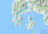
Where is Everest
Everest is located on several hundred square kilometers, on the territory of mainly two states - Nepal and China. Chomolungma is part of the Himalaya mountain system, the Mahalangur Himal range (in the part called the Khumbu Himal). Perhaps no other peak on our planet attracts people to conquer it like Chomolungma.
Climbing Everest
The mountain was first conquered on May 29, 1953 by Sherpa Tenzing Norgay and New Zealander Edmund Hillary.
Since the “ascending travelers” were counted, about three hundred people have already died. Even the most modern equipment and equipment do not allow all the thirsty inhabitants of our planet to conquer this height.
About five thousand people try to conquer Everest every year. By 2018, more than 8,400 climbers managed to reach the summit, almost three and a half thousand of them climbed Everest more than once.
Climbing Everest takes about 2 months - with acclimatization and setting up camps. Climbers lose on average 10-15 kilograms of their weight during this time.
The most dangerous section of the climb is considered to be the last 300 meters to the top. Not all climbers can overcome this part. At the top there are often strong winds of up to 200 km/h. And the temperature throughout the year ranges from 0°C to -60°C.

Second highest mountain in the world, Chogori (K2)
Chogori (second name K2) is the second highest peak on the planet, but climbing it is considered much more difficult. Moreover, in winter, no one managed to conquer it at all, and the mortality rate when climbing this peak is the highest and amounts to 25%. Only a few hundred climbers managed to conquer this height.
In 2007, it was Russian climbers who managed to climb the most difficult section of the peak, the Western Wall, and they did it without the use of oxygen equipment. The most massive conquest of Chogori took place in the summer of 2018. Of the group, which consisted of 63 people, one died. At the same time, Andrzej Bargiel became the first climber to descend alpine skiing from the top of this mountain.

Kanchenjunga
Kanchenjaga is the third highest eight-thousander on the planet. Located in the Himalayas. Until the mid-19th century, it was considered the highest mountain peak, but now, after calculations, it ranks third in height. At the moment, more than ten climbing routes to this peak have been laid. Translated from Tibetan, the name of the mountain means “treasury of the five great snows.”
Due to its location, Kanchenjaga partially belongs to the national park of the same name in India. If you look at the mountain from India, you will notice that there are five peaks in this mountain range. Moreover, four out of five peaks rise to a height of more than eight thousand meters. Their combination forms a very colorful landscape, so this mountain is considered the most picturesque among its kind. One of the favorite places of creation of Nicholas Roerich.
The first conquest of this peak belongs to the English climbers Joe Brown and George Bend. It was committed on May 25, 1955. In Nepal, for a long period of time, there was a legend about Kanchenjaga - a mountain woman who does not allow the fair sex to conquer her peak. Only in 1998 did the British Ginette Harrison manage to do this. The general trend towards a decrease in the mortality rate when conquering mountain peaks unfortunately did not affect Kanchenjaga and is 22 percent.

Lhotse
Lhotse, a mountain peak on the border of China and Nepal, has an altitude of 8516 meters. The mountain is located in close proximity to Chomolungma, the distance between them does not exceed 3 kilometers. They are separated by the South Col pass, the highest point of which almost reaches eight thousand. Such proximity of two great peaks creates a very majestic picture. From a certain angle you can see that Lhotse is like a triangular pyramid. Moreover, at the moment there is the smallest number of climbing routes for each of these three faces. This is largely due to the fact that the slopes of the peaks are very steep, and the likelihood of avalanches is extremely high.
Unlike Chogori, this peak was still conquered in winter. It is worth noting that so far none of the individual climbers or groups have been able to climb the traverse of all three peaks of this eight-thousander. The Eastern Wall of Lhotse also remains unconquered.

Makalu
Makalu is extraordinary beautiful peak, but extremely difficult to climb. Less than 30% of organized expeditions ended in success. The mountain is located on the border of China and Nepal, a little more than 20 km southeast of Everest.
The mountain did not attract much attention for more than a hundred years after it was marked on maps. This is largely due to the desires of previous expeditions to conquer higher peaks located in close proximity to it. The peak was first conquered only in 1955.
In certain circles the mountain is known as the “black giant”. This name was assigned to it due to the fact that the extremely sharp ribs of the peak do not allow snow to settle on them, and it often appears before its contemplators as black granite rocks. Since the mountain is located on the border of two eastern countries, its conquest is related to mystical factors, supposedly the mountain itself decides which of the expeditions is allowed to climb and who is not worthy of this fact.

Cho Oyu
The height of Cho Oyu is a little over 8200 meters. Near the peak lies the Nangpa-La pass, through which the main “trade route” of the Sherpas from Nepal to Tibet passes. Thanks to this route, many climbers consider this peak to be the most accessible of all eight-thousanders, although this is not entirely true. Just on the Nepal side there is a very steep and complex wall, so most of the ascents are carried out from the Tibet side.
The weather in the Cho Oyu area is almost always favorable for climbing, and its “accessibility” makes this peak like a springboard before climbing Everest.

Dhaulagiri I
The number one perfectly reflects the essence of the name of the mountain; it consists of many ridges, the highest of which reaches a height of 8167 meters. It is believed that the mountain has 11 peaks, of which only one is higher than 8000 meters, the rest lie between 7 and 8 kilometers. Dhaulagiri is located in the central part of Nepal and belongs to the Main Himalayan Range.
Despite the complexity of the name, it is translated very simply as “white mountain”. The history of its conquest is interesting. Until the 30s of the 19th century, it was considered the highest mountain on the planet. But they started conquering the peak only in the middle of the last century. For a long time it was impregnable, only the eighth expedition managed to reach the top. Like its other brothers, this peak has its own simpler routes and very inaccessible slopes.

Manaslu
The mountain is located in the northern part of Nepal and reaches a height of 8163 meters. Due to its relative seclusion, this peak looks extremely majestic against the backdrop of the surrounding splendor. Maybe this explains its name, which means “mountain of spirits.” For a long time, climbing the mountain was difficult due to hostile local residents (the name of the mountain speaks about this). Avalanches often fell on local settlements, and only after long offerings to the highest gods did the Japanese expedition finally manage to conquer this peak. The mortality rate among climbers conquering Manaslu reaches almost 18 percent.
The mountain itself and its surroundings are part of the Nepal National Park of the same name. The indescribable beauty of the park prompted the country's authorities to create a walking route for lovers of mountain recreation.

Nanga Parbat (Nanga Parbat)
One of the few eight-thousanders located not in China or Nepal, but in territory controlled by Pakistan. There are four main peaks on the mountain, the highest of which is 8125 meters. The top of the mountain is among the top three in terms of the number of deaths during its conquest.
In terms of the history of the ascent, an interesting fact is that it was on this mountain that the first attempt to climb an eight-thousander was made. This happened back in 1895. The first conquest of the peak alone, and not as part of a prepared expedition, is associated with this mountain. There are beliefs that it was here that the symbols of Nazi Germany, whose representatives, as we know, were close to the occult sciences, were first noticed.
Certain difficulties in planning expeditions to this peak are caused by internal political disagreements on the territory of Pakistan.

Annapurna I is the most dangerous peak among eight-thousanders
Annapurna I is the first of the eight-thousander peaks, whose height is already below 8100 meters (officially 8091 meters). However, for all the years of climbing taken into account, she has the highest mortality rate among conquerors, almost one in three (32%). Although at present it is steadily declining from year to year. Annapurna is located in central Nepal and the entire mountain range stretches for more than 50 kilometers. Consists of many ridges of varying heights. From the highest points of Annapurna you can observe another giant - Jaulaguri, about 30 kilometers between them.
If you fly near these mountains by plane, you will see a majestic view of the nine main ridges of this massif. It is part of the national park of the same name, located in Nepal. There are several hiking routes along it, along which indescribable views of the Annapurna peaks open.

Gasherbrum I
The summit of Gasherbrum I is part of the Baltoro Muztagh mountain range. Its height is 8080 meters and it is the eleventh eight-thousander on the planet. It is located in Pakistan-controlled territory near the border with China. Translated it means “beautiful mountain.” It also has another name - Hidden Peak, which translated from English means hidden peak. In general, the Karakoram mountain system, to which Gasherbrum belongs, has seven peaks, and three of them exceed 8 thousand meters, although not by much.
The first ascent of the peak dates back to 1958, and in 1984 the famous climber Reinhold Messner makes a traverse between Gasherbrum I and Gasherbrum II.

Broad Peak
The second highest peak in Karakurum, the middle brother between the two sisters Gasherbrum I and Gasherbrum II. In addition, literally 8 kilometers from Broad Peak there is another high relative - Mount Chogori. The first ascent of Broad Peak took place a year earlier than neighboring Gasherbrum I, in 1957
It itself consists of two peaks – Pre-summit and Main (8047 meters). The southwestern slopes are much easier than the opposite, northeastern ones, and it is on them that the classic routes to the Main Peak are laid.

Gasherbrum II
Just below Broad Peak there is another peak among the eight-thousanders - Gasherbrum II (height 8035 meters). Either its relative lowness affected it, or for another reason, but the first ascent to this peak dates back to a year earlier than on Broad Peak, in 1956. The main routes of peak conquerors pass along its southwestern slope. It is least susceptible to mountain falls and avalanches. It is used by many climbers who begin to conquer everything above 8 kilometers.
This mountain fully justifies its name; in good weather, the boundaries between gray and black limestone rocks are clearly visible, corresponding to different age boundaries, which, in combination with crystal clear snow, creates unique landscapes.

Shishabangma
The majestic iceberg with a height of 8027 meters is the lowest of all known eight-thousanders. Located in the Himalayas, in China. It consists of three peaks, two of which - Main and Central (8008 meters) exceed 8 kilometers. Translated from the Tibetan language it means “harsh climate”.
The first conquest of this peak was made by a Chinese expedition in May 1964. It is considered one of the least difficult peaks, although more than 20 climbers have died on its slopes over the past years.

The highest mountains in the world on the world map
This is a brief overview of all 14 eight-thousanders on the planet. Each mountain is unique in its own way and the saying applies to each of them: “only mountains can be better than mountains.”
There are many high mountains in the world that climbers have managed to conquer. However the most high mountain in the world remained unconquered for a long time.
The highest mountain in the world
The highest mountain in the world is Chomolungma (Everest). Its height is 8,848 m above sea level.
In this case, it is worth paying attention to the clarification “above sea level”, since if you measure the height of the mountain from the core, then the record will belong to the extinct Chimborazo, which is in.
Everyone knows that our planet has the shape of an ellipse. It follows from this that mountains located near the equator are higher than in other areas of the Earth.
 Height from the center of the earth
 In this regard, Chimborazo is located closer to the convex center of the Earth than any other mountains, including Everest.
The most difficult mountain for climbers
Considering all the above facts, the question inevitably arises: why is Everest the most popular mountain in the world, while Ecuadorian Chimborazo (6384 m) remains in the shadows?
This is largely due to the difficulties in climbing Chomolungma.
Let's imagine that we want to conquer both of these peaks.
Climbing Chomolungma
In order to climb Everest, you will first have to reach the base camp.
This part of the journey will take you about 10 days. After this, it will take another month and a half for acclimatization alone!
 View of Everest from an airplane
 Then you will have to climb directly to the top for about 9 more days. And this is the most difficult part of the path.
Climbing Chimborazo
Now let's imagine how long it will take to conquer Chimborazo.
When climbing, acclimatization will take you no more than 2 weeks, and the journey to the top will not exceed 2 days.
 Chimborazo
 From all that has been said, we can conclude that after Everest, climbing the Ecuadorian peak will seem like an evening walk to you.
"Above" and "below" sea level
So, Everest is the highest point on the planet above sea level.
However, speaking about the high mountain in the world, and taking into account some other factors, it is appropriate to recall one more grief.
If you measure the absolute height from the base to the top, then the highest mountain will be Mauna Kea, located in the territory.
 Mauna Kea
 It may be difficult for some to understand what we are talking about, so let's sort out this confusion one by one.
Unlike Everest, most of Mauna Kea lies below the surface of the water.
Thus, if we measure the height from the base (underwater) to the top, it will be 10203 m, which is 1355 m higher than Chomolungma.
 Everest and Mauna Kea
 Mauna Kea is an extinct volcano that last erupted approximately 4,600 years ago. An interesting fact is that there are 13 telescopes on the top of this mountain.
This is due to the fact that there is a very low level of humidity and clear sky. Thanks to this, astronomers can monitor celestial objects while studying outer space.
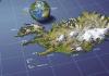
The highest mountains on each continent
- Europe – (5,642 m)
- – Kilimanjaro (5,895 m)
- Asia – Everest (8,848 m)
- – Aconcagua (6,962 m)
- North America– McKinley (6,190 m)
- – Vinson massif (4,892 m)
- – Kosciuszko (2,228 m)
Now let's return again to the highest mountain in the world - Chomolungma, and learn not only its geographical features, but also how man conquered it.
Chomolungma is located on the Mahalangur Himal ridge in. It occupies such a large area that its base is located on the territory of the Tibet Autonomous Region.
Over the centuries, the mountain has attracted the attention of many people who wanted to be at its peak. As a result, hundreds of climbers who tried to conquer Chomolungma died.
Attempts to conquer Chomolungma
It is officially believed that Briton George Mallory was the first climber to attempt to climb the mountain. However, he and his partner failed to achieve their goal.
They died on one of the slopes of Chomolungma back in 1924. It is interesting that their bodies were discovered only in 1999. According to experts, they were only 200 m short of conquering the mountain peak.

After this expedition, many more daredevils tried to reach the peak of Everest, but they all either died or returned back, not daring to set foot on the most dangerous sections of the path.
As mentioned earlier, climbing Mount Qomolungma is accompanied by many different difficulties:
- High atmospheric rarefaction (lack of oxygen);
- Low temperature (below -50°C);
- Hurricane winds, as a result of which the human body feels frosts down to -120°C;
- Solar ;
- Frequent avalanches, steep slopes, falling into crevices.
First ascent of the highest mountain in the world
When did the first successful ascent of the highest mountain on earth take place?
And this happened a little more than half a century ago.
On May 29, 1953, New Zealander Edmund Hillary, together with Sherpa Tenzing Norgay, were able to conquer Everest, as a result of which they became the first people to reach its summit.
It is worth noting that before setting off on the expedition, they carefully prepared for it.
The climbers took oxygen equipment with them and chose the most convenient route. Having reached an altitude of 8500 m, they set up a tent for the night.
The climbers woke up in the morning to find their boots covered in ice.
It took them about 2 hours to defrost their shoes and make the final push to conquer Everest.
A few hours later they were already at the top, where they spent about 15 minutes. During this time, the climbers took several photographs and planted a flag.
Having descended to earth, they immediately became real heroes. The entire world press wrote about their feat, wanting to know all the details of the expedition.
In subsequent years, Qomolangma was conquered by climbers from different countries. The first woman to reach its peak was Japanese Junko Tabei (1976).
Despite the fact that today hundreds of people continue to die on Everest, this mountain still arouses the greatest interest among extreme sports enthusiasts.
It is curious that Chomolungma was conquered in a variety of ways. They climbed it without oxygen masks, descended from its peak on skis and snowboards, and also competed in the time spent on its ascent.
 View of the northern wall of Qomolangma from the path leading to base camp
 An interesting fact is that the youngest person to visit the highest mountain in the world was a 13-year-old Indian girl, Purna Malavath, and the oldest person was 72-year-old American Bill Berg.
According to official data, more than 260 people died on the slopes of the mountain, and about 8,300 climbers have already conquered the peak of Chomolungma.
Who knows what other records will be set in the future, but it is safe to say that Everest will forever remain the most popular mountain in the world.
Now you know what the highest mountain in the world is. If you liked this article, share it on social networks.
If you like it, subscribe to the site IinterestingFakty.org. It's always interesting with us!
Did you like the post? Press any button.
The program of climbing the highest peaks of all continents has an abbreviated name, which can also be called a brand - “Seven Summits”. In English, which is understandable to the whole world - “Seven Summits”. This is one of the mountaineering collections, the implementation of which is an incentive to determine goals in life for hundreds of citizens of different countries. The vast majority of those who climb Everest, one way or another, make it their goal to complete this program. Because other peaks are easier and cheaper than reaching the highest point on Earth. It is very prestigious to become the first “seven-peaker” in your country, in your state, to become the first woman in the country, the oldest, youngest, fastest.
Climbing all seven peaks is very expensive. Even the most economical option will total close to 100 thousand dollars, not including the cost of equipment and preparation for expeditions. In reality, the optimal cost of the entire program is around 150 thousand dollars.
It is clear that such expenses are available only to very few climbers. If we are talking about personal funds. However, a minority of those who hunt for the “Seven Peaks” spend their own money exclusively. Most are supported by sponsors, governments, or travel on charitable fundraising programs. The legislation of, relatively speaking, “Anglo-Saxon” countries allows donations for the needs of a number of organizations to be deducted from the tax base. These are medical institutions, funds for helping veterans of military conflicts, the disabled, etc... By collecting donations for them, the climber “unfastens” a little for his travels. At the same time, more money is printed in these countries than in others, this leads to the fact that half of the list of “seven peaks” are citizens of the USA, Great Britain and Canada and Australia, which joined them.
The Seven Summits program was born in the first half of the 80s, when the first signs appeared that this could be done. The entire history of its occurrence is described in our article.
Let us recall that, according to encyclopedias: “continent” (from seasoned - strong, large), this is the Russian analogue of the European word “continent” (from Latin continens - singular). Continents are large tracts of the earth's crust, most of the surface of which protrudes above the level of the World Ocean in the form of land. Islands do not belong to continents and continents.
From a scientific point of view, the objects of the Seven Summits program are highly controversial. Firstly, the prevailing opinion among scientists is that Eurasia is one continent and its division into Europe and Asia is cultural, but not geographical. We are actively against this. If Elbrus is deprived of its status as the highest peak of the continent, the number of foreign climbers will decrease significantly. Although the status of the highest point in Europe for the Caucasian peak is very controversial. From the point of view of Soviet geographers, the border of the parts of the world runs along the Kuma-Manych depression, while Elbrus goes to Asia. There is even greater diversity of views on whether the Carstensz Pyramid should be considered the highest point in Australia. According to any scientific theory, the western part of the island of New Guinea does not belong to the “Green Continent”. These are all amusing debates and arguments that so far have practically nothing to do with practical life.
So, the 7 highest peaks of the continents are:
- Everest (Chomolungma or Chomolungma), 8848 m. Asia.
- Aconcagua, 6962 m. South America.
- Denali (old name - McKinley), 6194 m. North America.
- Kilimanjaro, 5895 m. Africa.
- Elbrus, 5642 m. Europe.
- Vinson Massif, 4897 m. Antarctica.
- Pyramid Carstensz (Puncak Jaya), 4884 m. Australia. Peak Kosciuszko (Kostyushko), 2228 m. Australia.
So, scientific debate on this topic is best left to those who are paid to do it. We love the magical (divine, as they say) number “Seven”, not “Six” (considered devilish). It doesn’t matter that there are eight vertices! And based on this we build our story. So, what mountains are included in the list of the highest peaks of the continents?
Everest (8848 m) - highest peak in Asia, continent of Eurasia and the highest peak of planet Earth (if you count from ocean level), also the highest in the Northern Hemisphere of our planet. The mountain is located on the border of Nepal and Tibet (China). Numerous height measurements showed different results even with modern techniques. Therefore, the indicated height is conditional; it was adopted as a result of agreement, so as not to inflame passions.

Climbing Everest requires careful preparation, about two months of living in expedition conditions and overcoming the problems associated with being in the so-called “death zone”, at an altitude above 8000 meters. However, in modern conditions it can be stated that with the right organization and a sufficient degree of luck, every physically healthy person can climb Everest. Recently, ascents have been made mainly in the spring, during the so-called weather windows. This usually happens on the 20th of May. In this case, the routes from the south and from the north are first completely hung with railing ropes.
Climbing Everest, which 30-40 years ago meant joining the mountaineering elite, has become a commercial endeavor. Sports expeditions have become a rarity; most of the routes (all but two) are not repeated. The 7 Summits Club prefers to conduct expeditions from the North side. Here the permit is much cheaper, access by car to the base camp is possible and there are much fewer objective dangers (ice collapses and avalanches). Western firms prefer the southern route. First of all, fearing the unpredictability of the Chinese authorities, who may close the area for minor reasons, without any compensation to the organizers. Individual participants may not be given a visa for political reasons. But there is another point: in the South, with a higher price, the organizers’ profits are much higher than in the North.

*******
Aconcagua (6962 m) is the highest peak in the world of America and the continent of South America, also the main one in the southern hemisphere of the planet. The mountain is located in Argentina, a large and colorful country. The ascent to Aconcagua is a real high-altitude ascent, which is carried out, so to speak, under the conditions of a lightweight expedition (the duration of the trip is only 20 days). Separate cargo transportation at the bottom of the route makes the ascent easier, as do certain amenities at base camp. There are no technical difficulties on the classic route, however, there are plenty of physical ones. First of all, this is height, the reaction to which is often unpredictable even among experienced athletes. The main obstacle is considered to be strong winds, which are associated with the openness of the territory to air masses from the oceans.

Every year, about 3,000 climbers attempt to climb Aconcagua. They climb two gorges from two base camps. However, the routes at the top are the same. About half of the participants achieve success. This is due to the lack of preparedness of the climbers. And partly with the attitude of local guides, who are not risk-averse and, at any opportunity, are ready to turn the whole group or individual participants around. So we strongly recommend joining a group led by visitors, Russian speaking guides. Better - from our company...
Climbing programs on Aconcagua are becoming more expensive from year to year due to the policies of local authorities. So don't delay.

*******
Denali (6194 m) - the highest peak of mainland North America. Located in the USA, in the state of Alaska, near the Arctic Circle. A typical climb takes approximately three weeks, of which two weeks are strenuous work in the glacier zone, in conditions close to extreme. Participants are required to use purely mountaineering skills to a greater extent than on other peaks of the “seven”. In this case, all cargo must be carried independently, including recycled waste. And when organizing a trip to Denali, you will have to solve the puzzle of obtaining an official permit and an American visa. All this is not at all difficult if you start in time.

In recent years, the number of climbers aiming to climb Denali has stabilized at around 1,500 per year. A season is considered successful when the percentage of “climbing” is above 50%. The bulk of ascents take place in June - the first half of July. In mid-summer, due to the condition of the glacier, airplane flights become dangerous and cease by the beginning of August.
The American authorities issue permission to organize commercial programs only to a few companies and only with American “registration”. For us, this means the need to use American guides under an agreement with one of the local companies. Let's face it, agreeing on all the details of interaction with them was not a smooth process. The difference in the mentality of our two mountaineering schools is quite significant, but now mutual understanding has already been achieved and the problems are a thing of the past.

*******
Kilimanjaro (5895 m) is the highest peak of the continent and part of the world Africa. The mountain is located in Tanzania, close to the Kenyan border and the equator. It is considered the highest single peak in the world. Local National Park strictly regulates ascents and allocates a limited number of days for expeditions, on average a week. In this case, one of the goals is to ensure maximum employment for the local population working in group services. Therefore, for one climber there are two or even more employees of host companies.

Mount Kilimanjaro is located in the equatorial climate zone. The difference in temperature between seasons is minimal. Almost ascents can be made all year round
Due to the limited time, the ascent is carried out without sufficient acclimatization, which complicates the task of reaching the top for an unprepared person. And these turn out to be the absolute majority. Therefore, no more than one third of visitors manage to climb to the highest point. At the same time, almost all of our country’s representatives reach the top. What is at play here: the power of salt or greed (money has been paid)?
In any case, a trip to Kilimanjaro is an exciting adventure; getting to know the amazing nature of Africa and its people is simply amazing. This is the best way to love the “dark continent”, which many are wary of. And, of course, we consider it obligatory to include so-called “safari” excursions in national parks in the program.

*******
Elbrus (5642 m) is the highest peak in Europe. The mountain is located in Russia, slightly north of the Main Caucasus Range and, accordingly, from the border with Georgia. Climbing in favorable conditions requires only basic mountaineering skills and is accessible to all physically healthy people. However, the load will still be serious, and the effect of the height will make itself felt. The recommended period for the Elbrus climbing program is 9 days.

There is a fairly developed infrastructure that provides relatively comfortable living conditions on all days except the day of ascent.
Elbrus is still a territory of freedom. In this regard, only Kosciuszko can compare with him. Attempts to introduce payments do not meet with understanding from the majority of climbers.
There are no general statistics kept on Elbrus. An approximate estimate of the number of climbers is 25-30 thousand per year. The vast majority rises in July and August.

Programs of the 7 Summits Club on Elbrus
*******
Vinson Massif (4897 m) is the highest peak in the world and the continent of Antarctica. The mountain is located on an amazing ice continent that so far belongs to all of humanity. However, in the area of the very top, the absolute owner is the ALE (Antarctic Logistic Expedition) company, which determines the “rules of the game” here. But they are not able to make even the simplest calculations of how long the ascent will last; the actual “flight” schedule is dictated by unpredictable weather.

Since the price of an expedition to the Vinson Massif is very significant, only serious people get to its foot. And, as a rule, they successfully ascend, overcoming the terrible cold and wind.
It is important to dress correctly. But this is also checked.

*******
And the highest point of the part of the world and the continent of Australia, coupled with the colossal Oceania, is represented by two options: the Carstensz Pyramid and Mount Kosciuszko.
The Carstensz Pyramid, also known in Indonesian terms as Puncak Jaya (4884-5 m, on some maps even 5030 m) is the highest peak in Australia and Oceania. Located on the island of New Guinea. The most politically problematic mountain of the “Seven Summits”, which until then had been simply closed to visitors for 10 years. It is a rocky ridge of considerable length, located above the humid tropical jungle. Ascent and descent require skills in working with climbing equipment and rope. However, as part of a group and under the guidance of experienced instructors, overcoming difficult rocky areas is quite possible for anyone.

For quite a long time, there has also been a helicopter option, in which one flies to the base camp in a rotorcraft. However, there are pitfalls here too. Bad weather is a daily occurrence here, every flight is in danger of being disrupted.
Since Sir Edmund Hillary reached the summit of Chomolungma in 1953, every climber has dreamed in his heart of repeating this feat. The name “the highest mountain in the world” was given to Everest for a reason - the height of the mountain is 8.85 thousand meters. A lot of tourists and climbers from all over the world flock there every year.
 Everest - the highest mountain in the world
 When people talk about something extremely high, they mean distance above sea level. However, if we judge only by this parameter, then the exact height of the mountain will be 8 kilometers 849 meters. There is currently no competition in height on the planet. The mountain extends into the layers of the atmosphere much higher than other mountain peaks.
Interesting fact: At the moment there are 18 routes along which you can climb the mountain, making your dream come true.
Tallest mountain in the world from the center of the Earth
In this case, the highest point, in terms of proximity to the center of the planet, is considered to be the peak of Chimborazo. Its elevation above sea level is 6 kilometers 384 meters. Chimborazo is a layered volcano located in Ecuador. The volcano is part of the Andes mountain range.
 Chimborazo is the highest mountain in the world from the center of the Earth
 The Earth is not a smooth ball; it rises at the sides of the equator and flattens out a little at the poles. Thus, mountains near the Equator are located further from the center of the planet than those at the poles. Chimborazo is located closer to the Equator than Everest. This means that it is closer to space than even the highest point of Chomolungma (another name for Everest).
Related materials:
Nature - what is nature, nature of the world, photos and videos
Tallest mountain in the world from base to summit
Chomolungma is the highest mountain peak above sea level, but the highest mountain from base to summit is the Hawaiian Mount Mauna Kea, local people call it the White Mountain. The distance above sea level is 4 kilometers 205 meters, but the mountain goes down almost another 6 kilometers, since most of Mauna Kea is submerged in the depths of the sea.

The height of the mountain in its entirety is more than 10 kilometers, which is 1345 m more than the size of Everest. In fact, it's not really a mountain - Mauna Kea is an extinct volcano that arose about a million years ago. It was then that the tectonic plate on which the island is located moved over a plume of hot mantle inside the planet. The last volcanic eruption occurred approximately 2.6 thousand years BC.

The peak of White Mountain is a real find for astronomical observations. The humidity there is low, the sky is mostly clear, and the nearest light sources are at a decent distance, without illuminating the night sky. Thus, at the peak there is an excellent view of any celestial bodies. There are currently approximately 13 telescopes installed at the top of the mountain.
It's also worth noting that Everest officially remains the tallest mountain above sea level alone. Using this parameter, the remaining mountains cannot even claim the title of insurmountable peak of the Andes, which belongs to the peak of Mount Aconcagua, rising 6 kilometers 961 meters above the sea. However, even she is not a rival to Everest.
Where is Everest?

Everest is located in the Himalayan mountains on the Mahalangur Himal ridge. The Nepal-China border is also located there.
Interesting fact: there is an annual increase in the mountain of several millimeters.
What does Everest look like?
Everest looks like a three-sided pyramid with a more sloping southern slope. It is because of this that on the southern part of the mountain and on its edges, coarse-grained and fine-grained snow simply cannot be retained, so the stone protrudes under them. The northeastern shoulder of the mountain reaches 8393 meters in height, the distance from the top to the mountain foot is approximately 3550 meters. Mountain peaks are generally composed of sedimentary rock deposits.
Related materials:
Why aren't ozone holes filled manually?

The southern part of the mountain passes into the South Col pass, located at an altitude of 7906 meters, and also from Lhotse - 8516 meters. Some call it the South Summit of the mountain.
Interesting fact: The youngest climber who climbed to the top was 13 years old, and the oldest was 80.

In the north of the mountain there is the North Col, measuring 7020 meters, connecting the mountain with the separate peak of Changze, 7553 meters high. Towards the east, the Kangshung wall ends abruptly, 3350 meters. Glaciers constantly flow from the entire mountain range, ending quite high - at an altitude of 5 kilometers. Part of the mountain belongs to the Nepal National Park, the rest belongs to the PRC.
Interesting fact: To climb to the top of the mountain you will have to spend from 40 days to two months.

The summit of Everest aggressively welcomes climbers. There are constant winds raging there, the rarefied atmosphere makes it difficult to breathe normally. The speed of some air flows reaches up to 80 m/s, maybe even higher. The strongest winds and storms often blow here. The air around is very cold - the temperature drops to -60, which feels like -100 degrees Celsius. IN summer time The mountain is a little warmer than usual - the temperature rises to -19. There are never positive temperatures at the top. Without special equipment and acclimatization, it is not possible to survive on the mountain.
Flora and fauna of Everest
The climate is too aggressive for a mass of animals and plants to appear on the mountain. From flora there you can find small shrubs, mosses, lichens and some conifers. Animals on Everest are also not very common: jumping spiders, grasshoppers, flies and a few birds.
Every year there are fewer and fewer places on the planet that have not been spoiled by humanity, and the mountain area is also included among them. During the ascent, tourists are surrounded by picturesque landscapes. On the Nepal side, the mountain is fenced by two more mountain ranges, so for good visibility you have to walk several thousand meters.
Related materials:
How are icebergs formed?
Why is Everest called that?
The first map of Tibet was released in 1719, it was compiled according to the results of Chinese intelligence. The reconnaissance was carried out by lamas on the orders of the ruler of China. The European copy of the map reflected only the approximate location of the mountain; its name was not the same as on the Chinese original map.
From the Indian point of view, the mountain was called Discovery, but the last name was determined only in 1856. The mountain is named after the previous leader of the expeditions of the Survey of India, colonized by Britain, George Everest. Until about the 20th century, one could hear a lot of mountain names from India, but geography as a science did not take them seriously due to inaccuracies in location. The first representative of the Indian Review who was able to visit the area near Everest was Natha Singh. It was he who first heard the name of Everest as “Cholungbif”.

At the beginning of the winter of 1920, thanks to an employee of the British mission, Charles Bell, who at that time was trying to resolve the issue related to the ascent of the first English explorers to the mountain, a parchment was handed over. This parchment was presented by the Dalai Lama along with permission to climb. The words were written in Tibetan on the parchment that there was a monastery on the mountain. Part of the sentence was: "Cha-Mo Lung." This excerpt of the phrase interested researchers. A little later in Lhasa, the researcher was told that this was not a set of words, but the abbreviated name of Everest “Cha-Dzi-Ma-Lung-Ma”, next to it was the prefix “Lho”, which translates as the southern side.
In a special document that allowed the British expedition to climb the mountain peaks, issued by official representatives of the Tibetan authorities, the mountain was called “Chha-Mo-Lung Ma”. Later, this name was found in all climbing permit documents issued by the Tibetan government until 1936.
Related materials:
The science of geology: definition, meaning and object of study, photos and videos
The new name of the mountain became official many years later - in the 1960s. it was then that it became a documented geographical name for the area. Many translations of the name Chomolungma from Tibetan indicate that the mountain was called the Divine Mother of the Earth or Wind. Local residents refer to Everest as “the mountain over whose peaks no birds can fly.” Judging from the Nepalese side, the mountain was called “Sagannatha”, a similar name has been found since the 1960s, when the territories of Nepal and China were divided along the top of the mountain.
The meaning of “Chha-Mo-Lung Ma” is translated as “Divine Mother of Life Energy”. Everest is named after the deity of one of the schools of Tibetan Buddhism, Sharab Zhamma. The name of the goddess can be translated as the wisest and most loving mother. Thus, for certain schools of Buddhism, the mountain represents maternal energy. The mountain is also sometimes called “Chomogangkar”, which is also translated as “Holy Mother”. Because of the snow on the peaks, the phrase “white as snow” is added.

Chomolungma is the highest mountain. This fact forces tourists from all over the world to fly to this place. Climbing occurs regularly, but not every climber can survive the climb.
You will have to climb to the top within two months. This is subject to acclimatization, as well as regular tourist camps. When climbing, climbers lose about 15 kilograms. Countries around the mountain charge not only for climbing the peak, but also for related services such as translator, transport and communications. Each expedition climbs according to the order, the cheapest ascent is from Tibet. The most standard climb to the mountain starts from the north.
The rise is mainly carried out in the spring and autumn. Then there are no monsoons, so climbing is somewhat easier. The most suitable season for conquering Chomolungma is spring. In spring it is much easier to climb the opposite slopes of the mountain. In autumn it is much easier to climb on the south side.