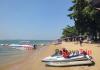
Ang Thong National Park is one of the main natural attractions of the country. It includes a group of 42 islands located in the Gulf of Thailand off the coast of Koh Samui (Surat Thani province).
From one of the most popular resorts - Koh Samui - to Ang Thong 35 km by sea. This is a real wonderland, consisting of blue lagoons and green islands, mysterious caves and exotic rock shapes.
Until 1980, the archipelago was closed and protected by the Royal Thai Navy, and only then was transferred from the status of a national park. But nevertheless, warships still patrol the sea in front of the islands.
Ang Thong means “golden pool” in Thai.
The main islands of the archipelago: Paluay, Wao Jiew, Wao Talub, Mae Khao, Samsao, Phai Luak.
The islands are mainly made of limestone, rising 10-400 meters above sea level. Limestone easily changes its structure under the influence of weather, which is why most islands have bizarre shapes. 
The depth of the sea here is very small - up to 10 m. Corals around the islands are not extensively developed, limited to a narrow strip and close to the shore of each island. Especially on the southern, western and north-eastern sides.
Climate of Ang Thong Park
The weather in the park is influenced by the monsoon, which creates large waves and rain. The average temperature throughout the year is approximately 27 degrees. The best time to visit the islands is between February and April. At this time the temperature is high, but the sea is calm.
Flora and fauna of Ang Thong Park
Most of the national park is open space. Land, islands - only 18% on earth. A thin layer of soil lies on top of the limestone rocks that make up the islands. The forest growing in this soil is divided into four types:
- Semi-evergreen forest - the main plants are Indian oak, lady's slipper orchid, and Calophyllum.
- Plants on the shore - tropical almond, coastal mahoe, Alexandrian laurel.
- Forest on limestone mountains - the main plants are spurge (genus Antiquorum Euphorbia), crinum lily.
- Mangrove trees - the only plant is the swamp small-leaved mangrove tree.
In general, the islands of the archipelago are densely covered with forest. It grows, among other things, on karst rocks and in shallow soils at the very top of limestone cliffs. Many trees and plants are very rare. Mangroves occupy shallow and muddy areas, growing mainly around Mae Ko Island and on the eastern side of Phaluai Island.
Rivers flowing into the Gulf of Thailand bring with them soil, parts of vegetation and other debris, making the water cloudy almost all year round. Not all inhabitants of the sea world like muddy water. Therefore, the main marine fauna of this area is represented by algae, mussels and oysters. 
There are wild animals and sea animals such as spectacled langur, parrot, Loma and whales. This area is a major breeding ground for mackerel, an economically important fish. Marine animals inhabiting these reefs include:
- Fish - butterfly,
- sea angel,
- Scarfish,
- Stingray - sea cat,
- black shark,
- Grouper
- and Cowrie shells.
Tourism in Ang Thong
Despite the fact that the islands are a conservation area, they provide accommodation for tourists. In addition, one-day excursions are actively brought here. 

It must be remembered that most of the islands are impenetrable jungles, through which it is impossible to travel as a “savage”.
Entrance fee to Ang Thong National Park is 200 Baht.
On the central island of Wua Talap you will be offered the following tourist infrastructure:
- bungalow;
- tent campsites.
You can even bring your own tent and rent a campsite or use the tents provided by the park administration.
There is a cafe-bar and restaurants.
Wua Talap Island
The main island is located in Kha Bay. All excursions come to this island. There is a good, clean beach here. 
 Visitors to the park are offered to climb a 500-meter mountain, from where a panorama of the entire archipelago opens. The view is truly stunning: the limestone islands form unusual shapes and bizarre silhouettes towering above the water.

The attraction of Wua Talap is the Bua Bok Cave. It is unique from a geological point of view, full of stalactites and stalagmites.
Island Mae Ko
The main attraction on this island is the mountain lake Thale Nai. It is a large natural reservoir lying in a bowl of karst mountains. The lake is salty, because has an underwater connection with the Gulf of Thailand. 

It is believed that it was formed as a result of a breakthrough of a thin layer of limestone base, which led to the filling of the depression with sea water.
Paluay Island
In all of Ang Thong, this island is the only one where there is a permanent population. And these are gypsies. Tourists are specially brought to Paluay, where they take an ethnographic excursion and are introduced to traditional life and the organization of life in a gypsy village. 

How to get to Ang Thong Park
You can travel to Ang Thong by speed boat. The journey takes about 1 hour. You can sail both from Samui and from mainland Surat Thani. There is no regular boat service to Ang Thong Park, only frequent carriers.
If you are far from the archipelago:
By vehicle:
- from Bangkok take Highway No. 35 (Thonburi-Pakthor),
- then along Highway No. 4 in the provinces of Phetchaburi, Chumpon and Prachuab Kiri Khun,
- along highway No. 41 to Surat Thani province.
The total route is 644 km. In the province of Surat Thani you need to get to Don sak and from there by ferry to Koh Samui, then by speedboat to Park.
By plane: On Thai Airline Public Co, Ltd. From Bangkok you can fly to the province of Surat Thani. Price about 2000 Baht. At Bangkok Airway Co, Ltd. from Bangkok to Samui island. Price about 3200 Baht. Flights operate every day, travel time is 1 hour 15 minutes.
From Koh Samui You can rent a boat with a boatman for the whole day for $100-$150. But check right away what time the boatman’s day ends - you may think that at 24-00, and then he will announce that at 17-00.
This is a convenient option if you want to travel around the entire park on your own without being tied to anyone. Arriving at the main island of Wua Talap, you need to pay the entrance fee. The services of a group guide, if necessary, are paid additionally.
But most tourists choose organized group excursions. Moreover, they recommend an overnight excursion.
On the island of Koh Samui there are many different tourist excursions both on the island itself, such as the blood-stirring one, and to the nearest islands. And today we are sailing to a drop-dead place - this Ang Thong National Marine Park!
One of the most basic and popular excursions on Koh Samui is a trip to the Ang Thong National Marine Park (Mu Ko Ang Thong National Park), which means “golden bowl” in Thai.
Just 35 km west of Samui - and a galaxy of paradise opens up before you: 42 islands of uninhabited jungle. Total 18 sq. km of land, the total area of the protected area is 102 sq. km. On November 12, 1980, this place was declared a park to preserve the nature of the islands and the magnificent coral reefs around them - all in their natural, pristine state. Only one of the islands is inhabited by Thais (they keep the park clean and tidy) and tourists who come for 1-2 nights; all the other islands are uninhabited.
Alex Garland glorified the archipelago by writing his famous book “The Beach”. The author was inspired by the incredible landscapes of Ang Thong. Later, based on this work, a film of the same name was made about tropical beauty and the depths of the sea with Leonardo DiCaprio in the title role.

Have you read the book or watched the movie? Write in the comments.
Finding yourself in these fabulous lagoons, plunging into the clearest sea, walking along snow-white beaches, inhaling the fresh aromas of the tropics and looking into mystical caves - you yourself become the hero of a novel or film. And don’t forget about snorkeling in the kingdom of rainbow corals and bright exotic fish. More than fifty species of birds, almost 40 species of reptiles, 16 species of mammals and 5 species of amphibians - all this makes the fauna of the island incredibly rich and diverse.
If you are not very familiar with the types of marine life, then in the park you will see with your own eyes a rich encyclopedia in living embodiment - butterfly fish, angel fish, parrot fish, teniura limma stingray, sea cucumber, giant venus, oyster, Malagasy night shark, snapper, grouper, blue crab, gorgonian alcyonaria and, of course, corals of all colors and sizes.
Before sailing, each tourist had glamorous ropes tied to his hands - bright green and pink. Later we learned that this division into “pink” and “green” was done on purpose - while the “pink” ones were kayaking, the “green” ones went up to the observation deck at the same time, then changed places. Thus, the flow of tourists is distributed.

They tie glamorous ropes to our arms
Traveling on your own to these places is difficult to implement, but a local travel agency easily organized this trip for us for 1,500 baht per person [data for 2014].
The fastest, most comfortable way to get to the park is speed boat. There are no more than 20-25 people on board, the entire route will take only 45 minutes, and there will not be large crowds at the disembarkation points. Such a pleasure will cost from 1700 to 2200 baht.

Speedboat with beautiful colors, looks like a zebra
If you like big companies and prefer not to rush, this is suitable for you ferry. The journey to the park will take about two hours. But due to its size, this ship will not be able to approach the main islands. Tourists are transferred to small boats and taken to the shore. Such an excursion will cost less - from 1200 to 1600 baht per person.

On the ferry you can drink tea or coffee, eat a banana and just have fun chatting
For those who love privacy and increased comfort, you can order individual tour. A speed boat is available. But the cost of such a route will be much more expensive - 15,000 - 25,000 baht.
Well, in the end, you can get to the Marine Park on one's own. Ships depart from the pier in Nathon every day, moving slowly but strictly on schedule. Departure at 8am, arrival in Angthong at 10:30am. But you won’t be able to walk around the archipelago for a long time - the return flight is already at 14:30, which will take you to Samui by 17:30 in the evening. The cost of such a trip is 700-1000 baht. But do not forget about additional costs - you will have to get from the hotel to the pier and back on your own. In terms of total costs, such a trip can cost almost the same as an organized tour. But if you decide to stay longer in the Marine Park and live there for several days, then this travel option is very successful.
As you may have guessed (if you watched the video), we are crawling like snails on a ferry...

Photo before departure, we were one of the first to arrive and are waiting for other tourists
But don’t be discouraged and enjoy the cool views opening before us.

Enjoying cool views from the bow of the ship
It's so nice to stand on the deck with the warm sea breeze blowing across your face.

It's so nice when the warm sea breeze blows on your face
From time to time we encountered lonely fishing boats on the open sea.

Lonely fishing boat. Isn't it beautiful?
To say that these places are very beautiful is to say nothing. During our trip to Thailand, this is perhaps the most beautiful natural attraction we saw.

View of one of the uninhabited islands in the National Park
And now the first island is visible ahead, called Mae Ko, which in Thai means Mother Island.

The first island is visible, called Mae Ko.
We were transferred to a long boat and slowly sailed to the shore.

Long Thai boats "longtail". In Thai they have an almost unpronounceable name “rya hang yao”
We sailed past a ferry boat, very similar to ours, but in better condition.

We sail to the island where the famous Emerald Lake is located

Everyone looks at the other ship and thinks, “Why do we have such a bucket, but they have...”
And finally we landed on the island.

Multi-colored canoes look so beautiful on the turquoise sea
Along a high winding staircase we climbed somewhere very high.

The stairs are almost vertical, but the climb is not very difficult
This is what the whole path looks like from the height of our flying camera:

View from above of the stairs and observation deck
With each new step, the view became incredibly fantastic, I wanted to turn around again and again.

The view from the middle of the path when climbing to the observation deck
The ascent takes approximately 10-15 minutes to a height of 150 meters. At the top there is a not very large observation deck (about 15-20 sq. meters).

Everyone happily waves to our “helicopter”
It offers a very beautiful view of the park itself and the endless sea around. Stay longer to take photos.

A crowd will stand around and watch you take photos. We play the game “photo without a Chinese person in the frame”
Having reached the highest point, we saw with our own eyes the very Emerald Lake Nai or Thale Nai for which we went to these parts. The lake is 250 meters long and 200 meters wide, approximately oval in shape. Its unusualness lies in the fact that it is surrounded on all sides by rocks, but at the same time the lake is connected to the sea through natural underground tunnels.

View of Emerald Lake from the observation deck
And, of course, we launch our helicopter into the air. If you haven't looked yet video, then be sure to do this to enjoy a bird's eye view of Emerald Lake and the surrounding area.
View of the observation deck from the side of the lake where our camera flew:

View of the observation deck from the side of the lake where our camera flew
You cannot go directly to the water of the lake; you can only walk along the bridges that are located on the rocks next to the lake. Swimming is also prohibited - the guide explained this due to the presence of very rare ancient fish. From above you can clearly see all the wooden structures built right on the rocks. You can walk along all of them and enjoy a unique view of the lake.

View of wooden structures from above, we are standing at the very top
Near the underground tunnel there is another observation deck - here you can see the rich underwater life. You can easily see sea urchins and fish and even barracudas and small reef sharks at the bottom, because the lake is shallow and the water is crystal clear.

Unrealistically beautiful view of Emerald Lake
This island was once a volcano, and after it died out, a lake filled the middle of the crater. The water brightly reflects the blue sky, and due to the light of the sun it becomes emerald. A very beautiful sight.

View of Emerald Lake
During this time, a mountain of life jackets and many, many canoes had gathered below.

Which one do you want?
By the way, from above we saw how they were melted down onto land. The ship resembles a big mother, and the canoe resembles little children on a walk.

The ship resembles a big mother, and the canoe resembles little kids on a walk
We swam in a canoe along steep cliffs from island to island (the entire route is approximately 500-700 meters, 30 minutes).

Canoeing along the rocks
Periodically we landed on snow-white beaches to swim in the crystal clear water.

We landed on some beach to swim

We didn’t even have time to take a couple of shots, but we already had to swim away
We went on this trip (as well as on) not alone, but with our friends from St. Petersburg. Due to the very busy pace of the excursion, we only had time to take one photo together.

We are with our friends from St. Petersburg
Kayaking is an exciting and mesmerizing activity.

Rowing is not as easy as it seems. After 10 minutes I want to throw away the oar and attach the motor
A voyage along the most uninhabited islands with their pristine white beaches,

Uninhabited island with a small beach
mysterious caves and rocks,

I really enjoyed swimming between these natural stones.
cleanest lagoons and lakes.

Our group on the “striped canoes”
We really like kayaking, we have already rented them several times and now we had the opportunity to swim in them near Samui. And it's really great!

Be sure to try it! It's pretty fun even if you don't like swimming
At full speed, our boat overtook us with a roar.

Eh, we could use a motor like this now...
We swim to the last beach on the route. What an amazing view!

One of the last stops, the whole route took about 30 minutes
We were picked up from the last beach in that same “long sea limousine” and taken to our snail.

The same boat takes us back to the ferry
And we once again admired the beauty of the sea and nature around.

We will never cease to admire these views!
A moment later, lasting half an hour, we found ourselves on the main island of Wua TaLap (Ko Wua TaLap), located in Kha Bay. Translated from Thai as “Sleeping Cow Island”.

View from the sea to the island of Wua Talap
Tall coconut trees line the snow-white sandy line. Here, in the northeastern part of the island, in the palm thicket, the headquarters of the Marine Park is located. The small complex of buildings is the modest housing of the park staff and their official canteen. There is also a place for visitors to have a snack - there is a specially built restaurant for them.

Aerial view of Wua Talap island
Some people arrive on the island early in the morning, in which case a speedboat comes in handy.

A speedboat is perfect for those who want to arrive on the island in the morning
The attraction of this island is an observation deck on a hill from where you can enjoy a magnificent view of the island,

This view opens from 200 meters, but you still have to get there...
visit to Bua Bok Cave

We didn’t have time to go to the Bua Bok cave, but we’ll go next time
or relaxing on the beach with breathtaking snorkeling and maybe even diving.

The water is the purest turquoise color, even despite the abundance of boats and tourists
Snorkeling is swimming with a mask and fins, without a long dive. Suitable for any age. The beauty that awaits you here underwater is incredible. The richest coral gardens - the variety of colors, shapes and sizes will surprise even the most spoiled. The colorful exotic fish scurrying back and forth in the sea thickets also add a fabulous quality to the underwater world. But that’s not all - if you decide to sail further away and scuba dive with instructors, then get ready to see tiger sharks, tuna, sea bass, and turtles impressively cutting through the surface.

View of Wua Talap Island from above
Most of the people lounged on the beach and swam in the sea.

Beach of Wua Talap island with beautiful coconut trees
And we, feet in hand, rushed barefoot 500 meters up the razor-sharp rocks. This hiking trail has the simple name “Pedestrian trail to the observation deck.”
Advice: Don't forget to take your shoes from the ship if you're passing by!
There are several observation platforms along the entire ascent route. The distance is quite difficult and requires some preparation. For insurance, a rope will be strung along the entire trail. At any moment you can grab hold, take a break and catch your breath. The highest observation deck is only accessible to the brave and resilient.
The first observation deck is already at an altitude of 100 meters. From here you can view the beach and several nearby islands.

The first observation deck at an altitude of 100 meters
Anyone can go up to this observation deck and enjoy a gorgeous view of the beach.

Gorgeous view of the snow-white beach
Three streams of sweat are already dripping from you, and the thought “it could go backwards” is flickering in your head.

I'm all wet and I want to go back
The road is of about the same quality with rocks, sharp stones and leaves underfoot.

This is the road in the forest, it’s convenient to hold on to the ropes

The stones are all incomprehensible shapes, this cannot be called a comfortable path
At around 200 meters there is the next observation deck. Horizons are expanding and interest is growing - but what next? The view is dazzling, but still low.

View from the observation deck at an altitude of 200 meters

At the top of the climb, be prepared to overcome a rocky section - only 50-70 meters.

When you turn back, you feel dizzy from such a height
The layered rock protrudes at an almost vertical angle - stone blades, like knives, rush upward to a height of up to half a meter.

I can't even believe we got up here
Good shoes and caution will come in handy here. And we regretted a million times that we didn’t take our flip flops.

We climbed barefoot. Don't repeat our mistakes!
I can’t even believe that we have finally reached it, and someone else is still climbing.

The reward for the hard climb is the last observation deck. Here you can straighten your shoulders and feel like a bird.

Breathtaking!
After all, the sight is incredible - the magnificence of the sea, the lush greenery of the islands and dazzlingly clean beaches.

View from the highest observation point, height 500 meters

View from the highest observation point, height 500 meters
Almost all the islands of the national park are visible. Or maybe even everything.

View from the highest observation deck, height 500 meters - you can see us a little on the observation deck

Enjoying the view from the highest observation deck, height 500 meters
The observation deck itself is small and already quite loose from the feet of numerous tourists.

View from the observation deck from the sea

We are standing there at the very top...
Who didn't watch video– turn it on right now and fly over these crazy landscapes with us.

Turn on the video (see at the beginning of the article)

We flew over this beauty and now we will show you the view even higher than 500 meters
Larger and smaller, rocky hills buried in the tropics, bizarre shapes and even characters - each island is individual and different from its neighbor.

View from the highest observation point, height 500 meters
Everywhere you look there is pure beauty.

Only our helicopter can reach the very peak of the mountain

Another beach is visible on the other side of the island

If you turn your head to the right, you will see such beauty

Just look how much greenery there is around
As it turned out later, the descent turned out to be even more difficult. There is nowhere to go, everything has already been looked at, and all that remains to endure is the pain on the balls of my feet.

It turned out to be more difficult to go down, about 1 hour
The ascent and descent took us a little less than 2 hours.

Such a forest nymph runs out. And how happy I was that we went down
The beach on this island will not leave anyone indifferent. Well, look for yourself. Just wonderful.

A funny shot was captured by our camera - the wind from the propellers was as if a hurricane had started


Aerial view of the beach of Wua Talap island
And the water at this beach has a fantastic color - from azure near the shore to emerald green in the depths.


And we just dived into this beautiful, even if not cool, water.

After such a hard climb it was very nice to take a plunge!

The water is clean and refreshing
Having explored the island from above, you can go deeper and explore it from the inside, visiting, for example, the Bua Boc cave. A short walk through the jungle - and another magnificent gift of nature awaits you: stalactites and stalagmites. The cave itself is a unique natural site due to its geological features. Unfortunately, we didn’t have time to visit it - we’ll leave it until next time.
By the way, on the island you can rent a bungalow, rent a tent and stay overnight. The cost of renting a bungalow for two people per night is about 500 baht (renting a tent is about 250 baht). Just take into account that the conditions here are quite spartan, there is no hot water, and after 23:00 the electricity is turned off. But if you want to be alone with nature, this is just the place you need.

Aerial view of the beach of Wua Talap island
Of course, we didn’t stay, we need to go charge the batteries and post a couple of videos on YouTube. There is no Internet here either.

We are waiting for our boat to come for us

Loading...

And now we are already rushing on the same boat to our ferry
At the end of the day we hosted gibbon flights from the deck of our snail.

We jump from the deck of the ship and compete to see who has the most splashes
While the boys were having fun, the girls were admiring the beauty around them. Some, like us, left the island, but others stayed on it to discover the beauty of the Thai night and enjoy the silence of the jungle.

Someone, like us, was leaving the island...
Everyone swam and tired and tired, but happy, we went back home to the island of Koh Samui.


Travel tips:
To make your trip to Angthong Marine National Park successful and give you an unforgettable experience and pleasure, carefully prepare and think through the route down to the smallest detail, not forgetting to take things that will make your trip comfortable and joyful.
Firstly, sunscreens and lotions - the sun is very active and the chances of getting sunburn are very high.
Secondly, comfortable clothes - light fabrics, long-sleeved sweaters and trousers will help here, several pairs of shoes - flip-flops for the beach, sneakers - for those who want to climb rocks. In the tropics, the weather is quite changeable, so that sudden rain does not take you by surprise, take an umbrella or raincoat. For a beach holiday, you will need a bedding, a swimsuit, shower gel or soap to wash off the salt after water procedures. Sunglasses to protect your eyesight.
And thirdly, do not forget to stock up on enough drinking water.
Cost of visiting Angkhthong Park:
As with all national parks in Thailand, entrance or, more precisely, entry to Ang Thong Marine Park is paid - 400 baht for each foreign tourist. If for a trip to the archipelago you have chosen a specialized company that is licensed for such excursions and is responsible for its passengers, then you will receive a discount - 50% of the fee, that is an entrance ticket to the Marine Park will cost you only 200 baht, children under 12 years old - 100 baht. Indigenous residents of Thailand have the maximum discount - they pay only 80 baht. But it may also be that the cost of entry is already included in the tour and you won’t have to pay extra (this is exactly what happened to us)
The excursion lasts for the whole day - approximately 8 hours. The price of the tour includes transfer from the hotel to the ferry and back, the sea voyage itself, snorkeling, lunch, kayaking and relaxation on one of the islands. For an additional fee, you can be offered a Russian-speaking guide, but in our opinion, one is not needed on this trip.
This excursion also has its prohibitions: You cannot hunt or obtain any terrestrial or underwater animals, or take anything out of the park.
A few facts about other islands of the archipelago:
Samsao Island or "Three-Legged Island"
Samsau is located directly opposite the park headquarters, based on Mae-Ko. Among its attractions: a stone bridge of natural origin, intricately curved and leading to the sea, wild beaches where you can linger a little and live in tents, wonderful coral reefs. If you have time, be sure to snorkel there and enjoy the marine nature of this place.
Thaiphlao and Wua Kantang Islands
The islands of Thai Phlaw and Wua Kantang will delight you with dazzling white beaches and a variety of corals, which you can explore by taking short swims in the clear waters.
Hiking trails
"Pedestrian trail to the observation deck" located on the island of Wua Talap in Kha Bay and has a length of 500 meters. We were just climbing it.
"Exploring nature by boat"- these are two water routes. The first one runs along the coast of Phi Island, the length of the route is 600 meters. The second one runs between the beaches of Kha Bay and Nathap Bay, the length of the journey is 2200 meters.
"Exploring nature underwater"- under this name three routes for snorkeling are combined. 200 meters off the island of Thai Phlaw, and one hundred and fifty meter routes off the island of Sam Sau and Wua Talap in Kha Bay.
Main islands:
- Phaluai (พะลวย)
- Wua-Chiu - Wua Chio (วัวจิ๋ว)
- Wua Talap (วัวตาหลับ)
- Mae Ko (แม่เกาะ)
- Samsau - Samsao (สามเส้า)
- Phai Luak (ไผ่ลวก)
- Kha - Kha (คา)
- Hindap (หินดับ)
- Phi - Phi (ผี)
- Wua Kantang (วัวกันตัง)
- Pae Yat (แปยัด)
- Wua-Te - Wua Te (วัวเตะ)
- Naiphut (นายพุด)
- Changsom (ช้างโทรม)
- Hanuman - Hanuman (หนุมาน)
- Thaiphlao (ท้ายเพลา)
- Huaklong (หัวกล้อง)
- Khonban - Khon Ban (โคนบาน)
Map of the islands of Ang Thong National Park:

Map of the islands of Ang Thong National Park
We recommend an excursion to Angthong Marine Park as a must for all tourists visiting Samui. Mysterious caves, clear lagoons, lush greenery of the tropics, snow-white paradise beaches, fabulous corals and mysterious fish will leave you with an unforgettable experience and give you incredible emotions.
Cambodia: description of the country, how to get there and what to see, transport, cuisine and souvenirs [THE MOST COMPLETE AND UP-TO-DATE ARTICLE ABOUT CAMBODIA]
Koh Samui is so unusual! The 50-kilometer ring road runs along the ocean through an island strewn with coconut palms. Samui has a lot of beaches for young people and families with children. If you are going to relax on Koh Samui, read the basic rules of life on the island, the intricacies of tourism on Koh Samui and read reviews from tourists about Koh Samui in Thailand.
Thailand is a country in Southeast Asia, bounded by latitudes 5º37´ and 20º30´ north. It is believed that the beaches of the Gulf of Thailand coast are less popular than the beaches of Samui and its picturesque satellites, which are part of Ang Thong National Park.
Beginning tourists are interested to know where Samui is located. Why do websites about Samui inform about ?
Location of Koh Samui
A scrupulous approach to the upcoming trip gives rise to the question: “Where is Koh Samui Island?” On the map of Thailand, Samui is located 565 kilometers south of Bangkok, in the Gulf of Thailand in the Pacific Ocean. Our guide to Koh Samui or will help you get the exact answer.
Samui on the map
Often the name of the resort sounds like Koh Samui. In Thai, "ko" means island. It is only 80 km from the mainland, but its own was built on the territory. The geographical coordinates of the location of Samui Airport are 9º33´ N. latitude. and 100º4´ E. There is a ferry from the mainland city of Surat Thani to Koh Samui.
The total area of Samui is 247 sq. km., which is home to more than 30 thousand local people. Assessing the size of Koh Samui, we can say that it is the second largest island in Thailand. Despite the fact that Koh Samui is a coconut island and is associated with a world of pristine beaches, there is government control here. Thailand is a monarchy that has existed for over 700 years and is now constitutional. Having left the jurisdiction of Surat Thani in 2008, the settlement received the status of an independent city on Samui, consisting of 7 districts. The former administrative center (capital of Samui) - Na Thon (Nathon) - is still the seat of administration, as well as fishing and transport ports. This is where ferries from the mainland, as well as from the islands of Koh Phangan and Koh Tao arrive.
Islands near Koh Samui
Not far from Koh Samui are the large and lively island of Koh Phangan and the pretty, almost wild island of Koh Tao.
Koh Phangan
The rocky and mountainous island of Koh Phangan (aka Ko Pha Ngan) is located 16 km from Koh Samui. The island is famous for its Full Moon Party festival, which attracts thousands of fans of electronic music and nightlife every time.
Koh Phangan is predominantly made up of mountains, rainforests and coconut trees.
The highest point of the island is Mount Khao Ra, 627 m high, offering picturesque views.
There are practically no hotels on the island; the only good and expensive hotel on the island is Panviman Resort. More than a hundred bungalows serve as a substitute for hotels.
Koh Phangan area - 168 km 2
Population - 13,700 people
Ticket price from Samui to Koh Phangan - 250−300 baht
Travel time - 20−30 minutes
Koh Tao
The small and sparsely populated island of Tao is located 70 km from Koh Samui. Translated from Thai, Koh Tao means “Turtle Island” because it used to be home to a large number of sea turtles. Now the island is an ideal place for diving and snorkeling. If you want to see the amazing marine world of the Gulf of Thailand, be sure to come to Koh Tao.
Here, as well as on Koh Phangan, there are very few hotels. We can recommend Lem Cho Ro Beach and the Tommy Resort Hotel.
Area of Koh Tao - 21 km 2
Population - 1382 people
Ticket price from Samui to Koh Phangan - 600−700 baht
Travel time - 1.5−3 hours
History of Koh Samui
The history of the island city of Samui began in the 6th century AD. from a Chinese fishing village. In 1687 it appeared on the map as Pulo Cornam. China and Japan played a great influence on the culture of the island. The streets of Nathon with shops in old Chinese houses remind us of this. Until the 70s of the 20th century, there were no roads or resorts on Koh Samui. Tourism has developed since the late 80s. You can see what Koh Samui looked like in 1989 in the photo below.
Video about Samui
Climate and weather on Koh Samui
The climate of Samui is influenced by the geographical location of the island, because of this it differs from the climate of Bangkok. It has a tropical climate with high humidity levels. Due to the small temperature range, the difference in seasons is practically not felt. Conventionally, the weather is divided into 3 seasons: green or rainy season from July to November, hot from April to May and cool high season from December to March.
Cool refers to the high tourist season and is characterized by pleasant sunny weather with temperatures of 28 ºC - 32 ºC. The calm sea creates ideal conditions. At this time there is abundance, life on Samui is in full swing and prices are at their highest.
April and May are called the short Thai summer. The air warms up more, and on the island of Koh Samui in Thailand, prices become lower. April is the sunniest and hottest month (+38 ºC on average). Tourists who do not tolerate heat well should not take risks.
The rainy season in the Gulf of Thailand brings 2 times less rainfall than in the district. Peak humidity occurs in autumn. Thanks to this phenomenon, on the island of Koh Samui in Thailand, vacation continues, and the tourist lull occurs in -.
Average monthly climate characteristics
This is what the weather looks like by month on Koh Samui. To prevent active solar radiation from ruining your vacation, you should sunbathe before 11 a.m. and after 3 p.m.
The Thai currency in Koh Samui is the baht (THB). One baht is 100 satang. Banknotes for 10, 20; 50 (blue), 100 (red), 500, 1000 baht and coins 1, 2, 5, 10 baht and copper 25, 50 satang.

Once upon a time, for $1 you could get 30-25 baht. Despite the fact that THB is one of the most stable currencies in the region, at the beginning of 2017, $1 was worth more than 35 THB. One ruble was exchanged for 0.59 THB.
Many places accept Visa and Master Card, as well as Diners Club and American Express, which are less popular in Russia. The urban infrastructure of Samui contains enough banks and hotels with exchangers and ATMs.
In 2017, it was possible to withdraw money from the card at Krungsri Bank (“yellow bank”) without any commission. A photo of this bank is below:

The best transport option for holidays on Koh Samui is rented bikes and cars.


Many beaches offer transport for water activities (jet skis and pedalos). And, for example, on Maenam beach there are 2 berths for high-speed catamarans and boats heading to Phang Nga Bay, to Ang Thong National Park, to the islands of Phangan and Tao.


A beach holiday in Koh Samui 2017 will not be complete without visiting the nearby islands. There are a lot of ferries from Koh Phangan, ticket prices to which range from 150 to 300 THB per person. Boats, jeeps, motorcycles, and trucks act as taxis on the island, as elsewhere. You can go to Koh Tao Island from Nathon by taking the high-speed catamaran Songrerm and paying 200 THB for 1.5 hours of travel.
The local airport, Airport Koh Samui, is served by 2 airlines: Bangkok Airways and Thai Airways International. It should be noted that in roadside restaurants, airports, airplanes, buses, and taxis, air conditioners operate at full blast.
Driving on Samui is on the left.
Motorcycle taxis and songthaews - pickup trucks covered with awnings - take to the streets of Samui. A trip to a songthaew along one beach will cost from 100 baht. Regular flights on routes that end in Nathon cost 3 times more. From morning to 6 p.m., songthaews carry tourists at fixed rates. In Samui at night, the songthaew fee increases to the cost of a taxi.
To rent your own middle-class car, a traveler will pay about 1,200 THB per day. The cheapest option is to take a scooter (from 200 baht per day).

Almost 95% of Thais practice Buddhism. The main attraction of Samui island is the Big Buddha. A Buddha statue crowns the top of one of the hills on the northern coast. He “sits” in the lotus position, towering 15 meters, and “looks” at the sunset. Local residents erected the statue in 1972. Since then, they have paid respect to Buddha and brought gifts here. Monks living on the island gather nearby for meditation. They are accustomed to a strict lifestyle and follow 227 rules. According to the laws of the country, any man aged 13-18 years can become a Buddhist monk; he can be one for several days or months, for example, during the rainy season from the July full moon festival. Tourists come to buy amulets and souvenirs from nearby shops. You climb the mountain via the Dragon Staircase. This attraction of Samui is most often depicted by tourists in photographs.

Waterfalls and caves are considered natural wonders. The Hin Lad waterfall is famous for its cascades of several levels. The pool at its base is often visited by swimmers who prefer fresh water. In the northeastern part of Na Mueang district there is another picturesque waterfall. The length of its cascades is 80 m, and the spill at the base is more than 30 m. You can get to the waterfall on elephants.
Angthong National Park

| Mu Ko Ang Thong National Park includes 42 islands. Among them, the main islands are Phaluai, Wua Chio, Wua Talap, Mae Ko, Samsao, Phai Luak, Kha ), Hindap, Phi, Wua Kantang, Pae Yat, Wua Te, Naiphut, Changsom, Hanuman, Thai Phlaw (Thaiphlao), Huaklong and Khon Ban. |
|
The park covers an area of one hundred and two square kilometers, of which only eighteen square kilometers is land area. It does not cover the entire chain of islands; approximately 82% of the total area of the archipelago falls under its jurisdiction. The national park was created on November 12, 1980. |
|
| The basis of most of the islands is made up of limestone mountains ranging from 10 to 400 meters above sea level. Because the structure of limestones is easily altered by both chemicals and weather conditions, the islands are home to many intricate caves and cliffs, some of which look like the ancient temple of Angkor Wat in Cambodia or Prasat Hin Phimai. Climate
|
|
Flora and fauna
The islands are covered with four types of forests:
Dry evergreen forest, grows on large islands, there are significant areas of it on Wua Talap, Phaluay and Samsau. The main species of trees and plants here are memecyon ( Memecylon), Barringtonia ( Barringtonia), cashew ( Semecarpus), cinnamon ( Cinnamomum), rattan palm vines ( Caryota) and paphiopedium snowy ( Paphiopedilum niveum), which the locals call ‘ang-thong’.
Coastal forest grows in a narrow strip of beaches surrounding most large islands, especially in areas located above the maximum water level. Trees and plants found in coastal shelterbelts include the following species: Indian almond ( Terminalia catappa), thespesia vulgaris ( Thespesia populnea), calophyllum ( Carophyllum inophyllum), scevola takkadu ( Scaevola taccada), Erythrina latifolia ( Erythrina fusea), crinum asiatica ( Crinum asiaticum) and several types of pandan ( Pandanus). Forests on limestone substrates grow on open areas of rocks and on very fine soils that accumulate in rocky crevices on their tops. Most of their constituent plants are small-growing and maximally adapted to survive in harsh conditions. Dracaena lowereri ( Dracaena loureiri), ancient spurge ( Euphorbia antiquorum), and various types of morinda, or crinum ( Morinda). Mangrove forests prefer very calm areas of sandbanks and beaches, littoral areas, flooded during high tides and exposed during low tides. This type of forest is best represented on Mae Ko Island and the eastern part of Phaluai Island. The mangrove forest zone is very well defined by a cluster of trees, both old and young, among which Rhizophora short-acuminate predominates ( Rhizophora apiculata). Large islands with areas of relict forest are home to various species of animals. Here you can see spectacled clouded langurs ( Trachypithecus obscurus), Sumatran otters ( Lutra sumatrana), bats ( Vespertilio murinus), eastern reef herons ( Egretta sacra), Brahmin kites ( Haliastur indus), white-bellied sea eagles ( Haliaeetus leucogaster), carriers ( Actitis hypoleucos), algal swiftlets ( Aerodramus fuciphagus), making famous edible nests, Malabar white-billed ( Anthracoceros albirostris) and Indian hornbills ( Anthracoceros coronatus), gray drongos ( Dicrurus leucophaeus), white-necked alcyone ( Todiramphus chloris), monitor lizards ( Varanus), land ( Testudinidae) and sea turtles ( Chelonioidea), as well as pythons ( Python) of various types. The territory of the Gulf of Thailand, where the islands are located, is located in the continental shelf zone with a maximum depth of 10 meters. Thus, the islands rising from the bottom are surrounded by a relatively shallow sea. This means that the local sea waters are significantly influenced by the turbid water masses of mainland rivers. Fresh water does not collide with deep sea water, which would lead to a significant decrease in flow velocity and, accordingly, to sedimentation of suspended matter. For this reason, the water around the islands remains quite cloudy all year round. Coral colonies on the islands are very few in number and are limited to a narrow strip surrounding each island in the immediate vicinity of the coast, especially on the southwestern and eastern sides. Despite the fact that the northwestern parts of the islands are most susceptible to the influence of monsoons, coral colonies successfully develop in bays protected from the wind, especially pillar corals ( Dendrogyra cylindricus), brain corals ( Diploria labyrinthiformis), branched corals ( Acropora cervicornis), and in deeper waters there are various species of flat madrepore corals ( Scleractinia) and flower corals, goniopora ( Goniopora). Among the marine animals and fish inhabiting such reefs, you can find various species of butterfly fish ( Chaetodontidae), angelfish ( Pomacanthidae), parrotfish ( Scaridae), stingrays ( Batoidea), blacktip sharks ( Carcharhinus limbatus), sea bass ( Epinephelus) and many cowrie gastropod shells ( Cypraeidae), also called porcelain snails. |
|
Where the water is less clear, or in areas with strong undercurrents, species diversity is noticeably poorer, dominated by marine worms, crabs and brown algae of the genus Sargassum ( Sargassum) and turbinarium ( Turbinaria em). In places with steep rocky shores or very turbid water, hard corals are not able to survive. Only lovers of sedentary marine life are common here, including some species of gorgonians, or sea fans, oysters, mussels and other bivalves covering the surfaces of bare rocks. |
|
The waters of the Gulf of Thailand are very rich in microorganisms, which are a valuable resource that is the basis for the lush prosperity of many animals and plants. This wealth has existed for a long time, especially abundant in the waters around the Ang Thong archipelago. In the vicinity of the islands, commercial mining of some types of soft corals is permitted ( Alcyonaria), pinnacle bivalve mollusks ( Pinnidae), serving as a source of sea silk, various seaweeds and barnacles, as well as species of fish and marine animals of great commercial importance, such as mackerel ( Scomber), anchovy ( Engraulidae) and squid ( Teuthida).
Attractions
Wua Talap Island
Wua Talap Island is located in Kha Bay. The headquarters of the national park is located here. In front of it lies a beach with clean white sand, which is perfect for swimming and relaxing. Climbing to the observation deck located on the top of the mountain, at an altitude of about 500 meters, travelers can immediately see all the islands of Ang Thong National Park, stretched out in a bizarre line on the surface of the sea. A kilometer from the headquarters is the Buabok cave. In addition to the fact that it contains magnificent stalactites and stalagmites, due to its geological features, it itself is a unique natural object. 
Lake Nai, or Thale Nai
Lake Nai is a mountain lake on Mae Ko Island. It is a large natural reservoir surrounded by intricately shaped limestone rocks. Thanks to the tunnel, the lake communicates with the sea. Most likely, it appeared as a result of subsidence of the limestone substrate that forms its bottom. Perhaps this happened simultaneously with the birth of the island itself or during the process of erosion of limestone rocks, in the same way as the formation of caves.
Samsao Island Samsau is located directly opposite the headquarters of the national park based on Mae Ko. Its attractions include beautiful coral reefs, an intricately curved natural stone bridge leading down to the sea, and pristine beaches that are ideal for camping, swimming and exploring the coral.
I wanted to visit the Angthong National Marine Park back in 2009 when we first visited Samui, but the trip was postponed due to the fact that my wife developed seasickness, and I didn’t want to go alone. Angthong Marine Park - located 20 kilometers northwest of Koh Samui, includes 42 islands that occupy 102 square kilometers of area. All the islands are uninhabited and only one is home to the park administration and a small museum.
This year I found company - my mother came to us, and Vanya was already grown up, and the three of us finally decided to visit this attraction. Several companies supply tourists to Angthong Marine Park, but all prices are approximately the same. A speedboat excursion will cost 2,100 baht per adult and 1,500 baht per child over 4 years old. On a Thai boat 1850 baht for an adult and 1000 baht for a child in a program with kayaking or 1300 and 750 baht respectively without kayaking. We chose the most economical option, because firstly we wanted to save money, and secondly, I was already on a speedboat, so the choice fell on a Thai boat

We were lucky with the weather - the sea was very calm and the sun was not very hot. Even though we were traveling on a boat and not a boat, the arrival time was the same - 10:00. This is due to the fact that we set sail 30 minutes earlier (at 8:30, and those on the boat depart at 9:00), and secondly, we sailed from the pier in Nathon, from here the shortest path to the park, and those who boats depart either from Maenam or from Big Buddha, depending on the company.

The hour and a half of the road passed quite quickly, and on the way you could drink tea, coffee or water with cola.

We swam to the first island, those who had a kayaking program switched to kayaks and swam to our first stop, but we got there on our boat. All the people in kayaks swam 500-700 meters.

Our first stop was "Mae" Island at Angton Marine Park. The long boat in the photo is sailing behind us. The famous lake Talay Nai is located on this island. The lake is located in an extinct volcano and is connected to the sea by underground channels. It is from the sea that water flows into the lake, so it is salty. There are stairs to the lake, very steep ones by the way, along which you can climb to the top and look at the lake from above, or you can go down to the lake itself. True, you won’t be able to bathe in it; it’s prohibited. You won’t have to climb for long; it takes about 10 minutes to do this activity.
We moored to the island, the boat in the background is ours

We started climbing towards the lake, turned around, and there was such beauty

View of the lake from above

View of the lake from below

The water near Mae Island is clear, if you quickly run to the lake and go back down, you can have time to swim

While we were running around the island, kayaks were loaded into our boat

On the beach you can refresh yourself with a shake; I was pleasantly surprised that the prices here are the same as on Samui; in our country, drinks in such places usually cost an order of magnitude more.

Every time we were transported on a long boat to our boat, we were wearing life jackets

We loaded up and headed to the main island of the park - Wua Ta Lap. We had a snack on the way. Lunch is not fancy, but quite tasty

And so we are on the island of Wua Ta Lap.

Here you can 1 - go up to the observation deck from where you can see all the islands of the park, visit the Bua Bok cave and just relax on the beach and go snorkeling. We wanted to visit everywhere, but we were given only 2 hours of free time, this time was only enough for one thing. It’s not very clear why it’s so short, because the departure time is 15:00, it’s quite possible to stay here for up to 4 hours, walking.
I chose viewpoint, and my mother and son stayed on the beach. According to the sign, the viewpoint is only 500 m away, but these meters will have to be overcome along a very steep climb. The journey there and back took me an hour and a half.

The start of the climb and these are just the beginnings. To avoid falling, there is a rope stretched along the entire trail.

Having risen 100 meters you get to the first observation point, from it you can see the beach and several islands

You overcome another 100 meters and come to another observation point, the view is already better, but still low


And the last 50-70 meters are absolutely brutal, I don’t recommend climbing here in slippers

It is quite difficult for an unprepared person to climb, but from here there is such a gorgeous view that you forget about fatigue.

It is this picture that is used in advertising the tour to Angthong Marine Park. The descent is easy, except for the first 50 meters, although this is provided that you have good shoes. In total, the ascent and descent took me a little less than 2 hours. We only had 2.5 hours of free time, so I didn’t have time to visit the cave. I dived with a mask, the view underwater here is so-so, on Koh Tao it is much better. It’s a pity that we weren’t allowed to stay here for at least 4 hours. On the way home we could have a snack with a banana, drink tea, hot chocolate or water.

I liked the trip to Angthong Marine Park, I would recommend this excursion as a must for everyone who visits Koh Samui.

Our video (better to watch in full screen in HD quality)
You can book your tour to Angthong Marine Park directly from our website. Ecotel will be happy to organize your trip, and they speak Russian, which means there will be no language barrier.