Sakhalin has not always been separated from the mainland. At the dawn of civilization, the water level in the world's oceans steadily decreased, as a result of which so-called "bridges" arose in the strait. Presumably, it was along them that the first people moved here (about 300 thousand years ago). In the Middle Ages, the main inhabitants of Sakhalin were the Nivkhs and Ainu - small peoples who constantly migrated between the island and the Asian part of the mainland. Later, Tungus-speaking tribes were added to them. The very name "Sakhalin" appeared due to a geographical error. Due to an oversight, the Manchu name of the Amur River - Sakhalyan-Ulla - was correlated with the territory of the island. By the way, the literal translation of the word is “Rocks of the Black River”.
Until about the 50s of the 19th century, China ruled Sakhalin Island. At the same time, officially the territory did not belong to the Celestial Empire. In 1855, the governments of Japan and Russia signed the Treaty of Shimoda, according to which both states declared Sakhalin joint possession. However, after 20 years, Russia annexed the island, paying for it with Japan with the northern Kuriles. However, the joy of expanding possessions was short-lived. After losing in the Russian-Japanese campaign, the southern part of the island again went to the Land of the Rising Sun. The fate of Sakhalin was finally decided only after the Second World War, when Russia completely regained the island, and with it the previously lost Kuriles.

Economy and population

A little less than 500 thousand people live on Sakhalin, about 200 thousand of which are residents of the regional center, Yuzhno-Sakhalinsk. The vast majority of the population is Russian, although among the local inhabitants one can meet both Koreans and people from the former Soviet republics. But there are very few representatives of indigenous peoples here: only 1% of the total.
The economy of the region is unevenly developed, which is why the standard of living of the population in different parts of Sakhalin differs. For example, the northern part of the island, including Yuzhno-Sakhalinsk, exists due to oil production, while the remote and western regions, where production stopped during the collapse of the Soviet Union, are literally forced to struggle for existence. Ultimately, unemployment and a low standard of living led to the fact that most of the inhabitants of the Sakhalin periphery turned to poachers. Illegal shooting of wild animals, extraction of red caviar by barbaric methods are slowly but surely causing irreparable damage to the nature of the great island...
Climate and nature
Going on a trip to Sakhalin, it is better to prepare in advance for weather surprises. Since the climate of the island is temperate monsoon, the weather here is not stable. Local snowy and frosty winters are actively "helped" by atmospheric whirlwinds, bringing strong snowstorms with them. Spring here is long and cold, but summer is relatively warm, but short and often rainy. Another weather problem on Sakhalin is frequent and unpredictable cyclones, bringing with them devastating typhoons and floods.


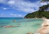
Sakhalin is an island with a unique ecosystem that was formed in a certain isolation. The terrain is formed by small mountains, low mountains and, to a lesser extent, low-lying plains, while 2/3 of the territory is occupied by taiga. By the way, there is no shortage of fresh water on Sakhalin: 17 rivers and over 16 thousand lakes provide abundant life-giving moisture for the flora and fauna of the island. Despite the fact that the flora and fauna of Sakhalin is somewhat poorer compared to the mainland or the nearest Japanese island of Hokkaido, it has something to surprise wildlife lovers. About 136 species of animals and almost 133 species of local plants are listed in the Red Book. In addition, here you can meet endemic (growing or living only in a specific place) representatives of the animal and plant world.

Sakhalin has become a true paradise for fans of fishing and hunting. The abundance of fish and game in local forests and reservoirs is difficult to describe in words. The Sakhalin taiga is also rich in mushrooms and berries. To collect a tasty "tribute", it is not necessary to delve into the impenetrable jungle. Lingonberries, blueberries, cranberries, redberries can be found here almost under every bush. However, it is not entirely reasonable to go to the other side of the country solely for the gifts of the forest, especially since the natural resources of the island are not limited to berries and fishing spots. There are also thermal springs, bathing in which can relieve chronic diseases, and fabulous caves filled with stalactite crystals, and sites of ancient people. True, it is worth noting that most of the local entertainment is suitable for those who are easy-going and ready to show at least minimal physical activity. Rafting, windsurfing, skiing and snowboarding, kayaking, climbing and paragliding, descending into mountain caves and unforgettable bike rides - this is not a complete list of activities that Sakhalin is ready to offer to supporters of an active lifestyle.

Sights of Sakhalin

The main and most valuable attraction of Sakhalin is its amazing nature. It is customary to come here not for high-quality European service and glossy sights, but for a delightful atmosphere of complete unity with nature, outdoor activities and an amazing feeling of complete freedom.
reserves
The most convenient and correct way to get acquainted with the wildlife of Sakhalin Island is local reserves, the most interesting of which is the Vostochny State Nature Reserve. You can get here only with a special permit issued by the Department of Forests, but the red tape with a pass is more than paid off by the impressions of the visit. It is here that you can meet such a rare phenomenon for the island as dark coniferous taiga, see how pink salmon, chum salmon and coho salmon spawn and take pictures of clumsy sea lions resting on coastal rocks. To get acquainted with the Sakhalin wild grouse and reindeer, it is better to go to the "Nogliksky" reserve. In autumn, reindeer races are held here, so if your visit to the island coincided with the autumn season, do not miss the opportunity to visit this unusual event. Well, the most interesting thing to watch bird "bazaars" is in the Poronaisky nature reserve, which occupies the eastern part of Sakhalin and the Patience Peninsula.


Volcanoes
Infernal vents filled with lava splashing in all directions are not about Sakhalin volcanoes. Here, craters spew out… land mixed with water. The Pugachevsky and Yuzhno-Sakhalinsk mud volcanoes even look non-trivial. Regular circles, devoid of vegetation and dotted with miniature "pores" of craters, resemble space landscapes from a fantastic blockbuster. By the way, the last major ejection from the Yuzhno-Sakhalinsk volcano occurred in 2011, as a result of which a new mud field formed in its vicinity.
thermal springs

Sakhalin nature not only pleases the eye, but also heals the body. If you find yourself on the island, be sure to swim in the Sinegorsk mineral springs, because water with such a unique composition is found only on Sakhalin and Adler. Today, there are 4 mineral wells in the Sinegorskoye deposit, the water from which is used for drinking, as well as for the treatment of diseases of the cardiovascular and musculoskeletal systems.
In the northeast of Sakhalin Island, in the Nogliki district, there is another unusual place - the Dagin thermal springs, which are funnel-shaped depressions in silty soil. Healing water with a high content of alkali, as well as silicic acid and a temperature of up to +40 ... +45 ° C, helps in the treatment of infertility and joint diseases. Once on the adjacent territory there was a balneary, but then the place gradually fell into disrepair. Today, only a modest dressing house reminds of the former glory of the natural resort. However, this did not make the springs less healing, and the place is still popular with both the local population and tourists.
lakes
One of the largest lakes on Sakhalin Island is Tunaicha. Located in the vicinity of the village of Okhotskoye, this beautiful reservoir is famous for the fact that about 29 species of fish live in it. In addition, it is in Tunaichu that the Sakhalin salmon comes to spawn. Officially, industrial fishing is prohibited here, but from August to September, amateurs are allowed to sit on the shores of the lake with a fishing rod.
Those who like more secluded places should book a tour to the South Reed Range, where the fabulous lakes of Mount Spamberg are lost on a picturesque plateau. 18 of the purest reservoirs, born as a result of rock falls, have their own, partially isolated ecosystem. The plateau area is also known for the fact that numerous springs and waterfalls of the Sakhalin region originate from here. Here you can also find the main waterfall of the island - Shuisky.

caves

Sakhalin is one of the most successful places for beginner speleologists. Acquaintance with local caves should be started from Mount Wajda. Fantastic multi-level dungeons, decorated with bizarre sinter formations, abound here. The intricate network of wells, underground passages and halls of Vaida has been assigned an average level of difficulty, so during the caving tour you will hardly have to complain about the mediocrity and monotony of the excursion. A trip to the cave of "Bear Tragedies" will bring no less impressions. The gloomy stone hall, which has become a kind of cemetery of bear remains, will remain in your memory for a long time. Once upon a time, during archaeological excavations, objects of an ancient cult, as well as tools of labor of the first people, were found here.
Moneron Island is located 43 km from Sakhalin, in the Tatar Strait. Today these lands are empty, although the first settlers appeared here in the first millennium BC. For some time, the island belonged to the Japanese, who seriously deteriorated its ecology, destroying most of the coniferous forests. A reminder of this era is the lighthouse, which remained here in memory of the Japanese colonization. Today Moneron has the status of a natural park and is actively visited by travelers. About 37 species of plants listed in the Red Book grow on the island, but among tourists Moneron is better known as a place of bird "bazaars", as well as rookeries of sea lions and seals.
Hunters and fishermen

At the disposal of tourists who come to Sakhalin to sit with a fishing rod and shoot local game, there are several recreation centers at once. As a rule, these are hotel-type houses, located in especially picturesque and at the same time inaccessible places on the island. You often have to use special equipment to get to them, but for real adventurers this is by no means an obstacle. "Upper", "Moguchi", "Lower" - each of the bases offers a similar range of services, including fishing, hunting, a Russian bath and other "brutal" pleasures. You can also get hold of hunting trophies in special farms. For example, the hunting tribal economy "Geeva" in the village. Nogliki invites his guests to "go" for a bear or an elk. 50 km from Yuzhno-Sakhalinsk is the Okhotsk farm, where anyone can shoot at hares and ducks, as well as try to catch chum salmon, pink salmon or taimen.
Skiers
On the outskirts of Yuzhno-Sakhalinsk, the main ski slope of the island is located - the tourist complex "Mountain Air". You can relax here with the whole family and at any time of the year, however, the base gathers the maximum number of guests during the winter months. Skiing, snowboarding, tubing - for each sport there is its own type of equipped trails with a total length of about 10 km. On the territory of the complex there is a rental of sports equipment, in addition, all the slopes of the camp site are equipped with special lifts. In the summer it is customary to come here to paraglide or rent a bike to explore the surroundings.
Remnant Frog on Sakhalin IslandMineral springs, volcanoes, ski slopes - all this is certainly interesting, but not entirely original. If you are one of those who crave unusual sights, welcome to the Krasnogorsk yew forest. Such a green massif, entirely consisting of century-old yews, is not found in any other corner of the planet. You can get a lot of positive emotions and as many spectacular photos on Tyuleniy Island, where the largest rookery of marine mammals is located. Fans of anomalous places, covered with mystical legends, should look into the remnant of the Frog. Well, you can taste the delicious gifts of Sakhalin nature at Uspenovskie cranberries. A vast treeless space, completely covered with a berry carpet, will appear in your dreams for a long time to come.

Museums
Despite the fact that Sakhalin is considered to be the land of nature tourism, some cultural entertainment is also available here. Art connoisseurs will be interested in visiting the exposition of the art museum, which is located on Lenin Street in Yuzhno-Sakhalinsk. You can get acquainted with the history, as well as the flora and fauna of the island in the local history museum, located in a colorful Japanese house on Communist Avenue. If you are traveling with children, be sure to take the time to visit the zoobotanical park, where you can see rare and endangered species of local animals. An interesting and informative excursion is offered to its guests by the Museum of the History of the Sakhalin Railway, which contains the rarest examples of railway equipment.
How to get there

You can get to Sakhalin relatively quickly and comfortably by plane. The Russian company Aeroflot operates several direct flights from Moscow to Yuzhno-Sakhalinsk. A standard flight usually takes from 8 to 9 hours. An option for those who are not looking for an easy way is the Vanino-Kholmsk ferry crossing. To get to the port of Vanino (Khabarovsk Territory), you must pre-purchase a train ticket on the route: Moscow-Khabarovsk or Moscow-Vladivostok (the trip lasts from 5 to 6 days). It is better to get from the Khabarovsk railway station to Vanino by taxi. The final stage of the journey is boarding the ferry and a 14-hour voyage through the Tatarsky Strait.
Sakhalin is an elongated island located in the Pacific Ocean. In the Russian Far East (between 45°50' and 54°24'N). Together with the Kuril Islands, it forms the Sakhalin region, the capital of which is Yuzhno-Sakhalinsk.
The island has a length from north to south of 948 km, with an average width of several tens of kilometers. The area of the island is 76,400 square kilometers, making it the 23rd largest island in the world.

Sakhalin Island is within walking distance of the Asian continent, from which it is separated by the Tatar Strait; in the northern part, the distance to the continent narrows to about 7 km. In the south, the La Perouse Strait is separated from the Japanese Hokkaido. The northern point of the island is Cape Elizabeth, and Cape Crillon is the southernmost point.
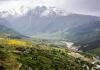
The territory of the island is mostly mountainous, with the exception of the northern part, where the northern lowlands begin. The central and southern mountains are mainly elongated in the meridional direction, the largest of which is the Western Range. In the Eastern chain, Mount Lopatina (1609 m) is the highest point of the island. There are no major rivers on the island.
Climate

Temperatures on Sakhalin Island are quite low, for its latitude, this is due to cold sea currents that bring cold to the shores of Sakhalin, the western shores of Sakhalin are the most exposed to cold.
The island has very cold winters, in January the temperature fluctuates between -18°C and -25°C in the north and between -6°C and -12°C in the south. The rise in temperature is very slow, due to the proximity of cold seas, so spring comes late, about three weeks later than on the mainland. The hottest month of the year is usually August, when the average temperature is between 11°C and 16°C in the north and between 16°C and 20°C in the south.
Population

At the beginning of the 20th century, about 32,000 Russians (of which 22,150 were deported) lived on the island along with several thousand natives. Currently, Sakhalin has 673,000 inhabitants, of which 83% are Russians. The 400,000 Japanese who lived in the southern part of the island were forced to take refuge in Japan after World War II. The capital, Yuzhno-Sakhalinsk, which has almost 200,000 inhabitants, is home to a small number of Koreans who were brought here during World War II to work in the coal mines.
Popular science film about the nature of Fr. Sakhalin, ecology and life of indigenous peoples
Sakhalin Island is a place of extraordinary beauty, vibrant nature and unique climate. Snow lies until the end of April, but the warmth of spring appears already in February. Summer unfolds at the end of June and pleases the whole of September. Soft colorful autumn is magical, and winter is crazy with countless winds and huge levels of snow.
Sakhalin is washed by the Sea of Okhotsk and the Sea of Japan, it is separated from the mainland by the Tatar Strait, 17 large rivers run through the territory of the island, and there are more than 16 thousand lakes. Great amount mushrooms, plants and animals found on the island are rare and protected. The relief of the island is composed of medium-altitude mountains, low mountains and low plains. The mountains, according to the tradition of the Far East, are called hills, the beauty of which is unforgettable all year round, especially in numerous passes.
Sakhalin Island: photos
Sakhalin Island: where is it located
It is washed by the waters of the Sea of Okhotsk and the Sea of Japan. It is separated from the mainland by the Tatar Strait, the width of which at its narrowest point (Nevelskoy Strait) is 7.3 km, in the south of about. Hokkaido (Japan) is separated by the La Perouse Strait. Stretched meridionally from Cape Crillon in the south to Cape Elizabeth in the north. The length is 948 km, with an average width of about 100 km, on the isthmuses of Sakhalin it narrows: on Okha to 6 km, on Poyask to 27 km. The area is 76.4 thousand km2.
Sakhalin Island on the world map

How to get to Sakhalin Island
There are two main ways to get to the island - air and water. As for the air: there are four passenger airports on Sakhalin: in Yuzhno-Sakhalinsk, Shakhtersk, Zonal and Okha. Of these, there are regular flights to various cities on the mainland, including Moscow, Khabarovsk, Komsomolsk-on-Amur, Blagoveshchensk, Vladivostok, Sovetskaya Gavan, as well as to various cities in China, South Korea and Japan.
Two airlines fly from Moscow to Yuzhno-Sakhalinsk: from Sheremetyevo - Aeroflot, from Domodedovo - Transaero. The local airline operating flights to different cities of the Far East is Sakhalin Airways.
There are no flights to Yuzhno-Sakhalinsk from the village of Zonalnoye and the city of Shakhtersk, but you can fly from them to Sovetskaya Gavan and Khabarovsk. This can be done with the help of Amur Airlines.
By water, you can get from Vanino (Khabarovsk Territory) to Kholmsk (Sakhalin Region). These ferries are daily and year-round. They go without a clear schedule, and the price rises every year, significantly outpacing inflation, plus it jumps depending on the season (more expensive in summer, cheaper in winter).
Sakhalin Island: video
Flight over Sakhalin
Picture of Sakhalin - a sunny island on Earth

Sakhalin island
Sakhalin- an island off the east coast of Asia. It is part of the Sakhalin Oblast, the largest island in the Russian Federation. It is washed by the Sea of Okhotsk and the Sea of Japan. It is separated from mainland Asia by the Tatar Strait (in the narrowest part, the Nevelskoy Strait, it is 7.3 km wide and freezes in winter); from the Japanese island of Hokkaido - by the La Perouse Strait.
The island got its name from the Manchu name of the Amur River - "Sakhalyan-ulla", which means "Black River" - this name, printed on the map, was mistakenly attributed to Sakhalin, and in further editions of the maps it was already printed as the name of the island. The Japanese call Sakhalin Karafuto, this name goes back to the Ainu "kamuy- kara-puto-ya-mosir", which means "the land of the god of the mouth".
In 1805, a Russian ship under the command of I.F. Kruzenshtern explored most of the coast of Sakhalin and concluded that Sakhalin is a peninsula. In 1808, Japanese expeditions led by Matsuda Denjuro and Mamiya Rinzo proved that Sakhalin was an island. Most European cartographers were skeptical of the Japanese data. For a long time, on various maps, Sakhalin was designated either as an island or a peninsula. Only in 1849 did the expedition under the command of G. I. Nevelsky put an end to this issue, passing on the military transport ship Baikal between Sakhalin and the mainland. This strait was subsequently named after Nevelskoy.
Geography
The island is elongated meridionally from Cape Crillon in the south to Cape Elizabeth in the north. The length is 948 km, the width is from 26 km (the Poyasok isthmus) to 160 km (at the latitude of the village of Lesogorskoye), the area is 76.4 thousand km².

Map of Sakhalin Island 1885
Relief
The relief of the island is composed of medium-altitude mountains, low mountains and low plains. The southern and central parts of the island are characterized by mountainous relief and consist of two meridionally oriented mountain systems - the West Sakhalin (up to 1327 m high - Onor) and East Sakhalin mountains (up to 1609 m high - Lopatina), separated by the longitudinal Tym- Poronai lowland. The north of the island (with the exception of the Schmidt Peninsula) is a gentle hilly plain.
The shores of the island are slightly indented; large bays - Aniva and Patience (widely open to the south) are located respectively in the southern and middle parts of the island. There are two large bays and four peninsulas in the coastline.
In the relief of Sakhalin, the following 11 regions are distinguished:
- The Schmidt Peninsula (about 1.4 thousand km²) is a mountainous peninsula in the far north of the island with steep, sometimes steep shores and two meridional ridges - Western and Eastern; the highest point is Mount Three Brothers (623 m); connected to the North Sakhalin Plain by the Okha Isthmus, the width of which at its narrowest point is just over 6 km;
- The North Sakhalin Plain (about 28 thousand km²) is a gently undulating area south of the Schmidt Peninsula with a widely branched river network, weakly expressed watersheds and individual low mountain ranges, stretching from Baikal Bay in the north to the confluence of the Nysh and Tym rivers in the south, the highest point - Daakhuria (601 m); the northeastern coast of the island stands out as a subarea, which is characterized by large lagoons (the largest are Piltun, Chaivo, Nyisky, Nabilsky, Lunsky bays), separated from the sea by narrow strips of alluvial spits, dunes, low sea terraces - it is in this subarea that the main Sakhalin oil and gas fields are located on the adjacent shelf of the Sea of Okhotsk;
- The West Sakhalin Mountains stretch for almost 630 km from the latitude with. Hoe (51º19 "N) in the north to the Crillon Peninsula in the extreme south of the island; the average width of the mountains is 40-50 km, the largest (at the latitude of Cape Lamanon) is about 70 km; the axial part is formed by Kamyshovy (north of the isthmus Belt) and South Kamyshovy ridges;
- The Tym-Poronai lowland is located in the middle part of the island and is a hilly-ridged lowland stretching for about 250 km in the meridional direction - from Terpeniya Bay in the south to the confluence of the Tym and Nysh rivers in the north; reaches its maximum width (up to 90 km) at the mouth of the Poronay River, the minimum (6-8 km) - in the valley of the Tym River; in the north it passes into the Nabil lowland; covered with a thick cover of Cenozoic sediments, composed of sedimentary deposits of the Quaternary period. sandstones, pebbles; the heavily swampy southern part of the lowland is called the Poronai "tundra";
- The Susunai lowland is located in the southern part of the island and stretches for about 100 km from Aniva Bay in the south to the Naiba River in the north; from the west, the lowland is bounded by the West Sakhalin Mountains, from the east - by the Susunai Range and the Korsakov Plateau; in the southern part, the width of the lowland reaches 20 km, in the center - 6 km, in the north - 10 km; absolute heights in the north and south do not exceed 20 m above sea level, in the central part, on the watershed of the Susuya and Bolshoy Takaya river basins, they reach 60 m; refers to the type of internal lowlands and is a tectonic depression filled with a large thickness of Quaternary deposits; within the Susunai lowland are the cities of Yuzhno-Sakhalinsk, Aniva, Dolinsk and about half of the island's population lives;
- The East Sakhalin Mountains are represented in the north by the Lopatinsky mountain junction (the highest point is the city of Lopatina, 1609 m) with ridges extending radially from it; two spurs of the opposite direction represent the Nabil Range; in the south, the Nabilsky Range passes into the Central Range, in the north, sharply lowering, into the North Sakhalin Plain;
- the lowlands of the Patience Peninsula - the smallest of the districts, occupies most of the Patience Peninsula east of Patience Bay;
- The Susunai Range stretches from north to south for 70 km and has a width of 18-120 km; the highest points are Mount Pushkinskaya (1047 m) and Chekhov Peak (1045 m); composed of Paleozoic deposits, at the foot of the western macroslope of the ridge is the city of Yuzhno-Sakhalinsk;
- The Korsakov plateau is bounded from the west by the Susunai lowland, from the north by the Susunaysky ridge, from the east by the Muravyovskaya lowland, from the south by Aniva Bay, has a slightly undulating surface formed by a system of flat-topped ridges elongated in a northeast direction; at the southern end of the plateau on the shores of Aniva Bay is the city of Korsakov;
- The Muravyovskaya lowland is located between Aniva bays in the south and Mordvinov bays in the north, has a ridged relief with flat tops of the ridges; within the lowlands there are many lakes, incl. the so-called "Warm Lakes", where people from South Sakhalin like to go on vacation;
- The Tonino-Aniva Range stretches from north to south, from Cape Svobodny to Cape Aniva, for almost 90 km, the highest point is Mount Kruzenshtern (670 m); composed of Cretaceous and Jurassic deposits.

View of the Sea of Okhotsk from the high shore near the lighthouse in the area of the Warm Lakes
Climate
The climate of Sakhalin is cool, moderately monsoonal (the average temperature in January is from -6ºС in the south to -24ºС in the north, in August - from +19ºС to +10ºС, respectively), maritime with long snowy winters and short cool summers.
The following factors influence the climate:
- Geographical position between 46º and 54º N. latitude. determines the arrival of solar radiation from 410 kJ/year in the north to 450 kJ/year in the south.
- The position between the Eurasian continent and the Pacific Ocean determines the monsoonal nature of the climate. A humid and cool, rather rainy Sakhalin summer is associated with it.
- Mountainous terrain affects the direction and speed of the wind. A decrease in wind speed in intermountain basins (in particular, in the relatively large Tym-Poronai and Susunai lowlands) contributes to cooling the air in winter and heating in summer, it is here that the greatest temperature contrasts are observed; at the same time, the mountains protect the named lowlands, as well as the western coast from the effects of the cold air of the Sea of \u200b\u200bOkhotsk.
- In summer, the contrast between the western and eastern coasts of the island is enhanced by the respectively warm Tsushima Current of the Sea of Japan and the cold East Sakhalin Current of the Sea of Okhotsk.
- The cold Sea of Okhotsk affects the climate of the island like a giant thermal accumulator, determining a long cold spring and a relatively warm autumn: snow in Yuzhno-Sakhalinsk sometimes lasts until mid-May, and the flower beds of Yuzhno-Sakhalinsk can bloom until early November. If we compare Sakhalin with similar (in terms of climatic indicators) territories of European Russia, then the seasons on the island succeed each other with a delay of about three weeks.
Air temperature and precipitation in Yuzhno-Sakhalinsk in the 21st century (temperature: II.2001-IV.2009; precipitation: III.2005-IV.2009):
| Options / Months | I | II | III | IV | V | VI | VII | VIII | IX | X | XI | XII | Year |
|---|---|---|---|---|---|---|---|---|---|---|---|---|---|
| Maximum air temperature, ºС | 1,7 | 4,1 | 9,0 | 22,9 | 25,0 | 28,2 | 29,6 | 32,0 | 26,0 | 22,8 | 15,3 | 5,0 | 32,0 |
| Average air temperature, ºС | −11,6 | −11,7 | −4,6 | 1,8 | 7,4 | 12,3 | 15,5 | 17,3 | 13,4 | 6,6 | −0,8 | −9,0 | 3,2 |
| Minimum air temperature, ºС | −29,5 | −30,5 | −25,0 | −14,5 | −4,7 | 1,2 | 3,0 | 4,2 | −2,1 | −8,0 | −16,5 | −26,0 | −30,5 |
| The amount of precipitation, mm | 49 | 66 | 62 | 54 | 71 | 38 | 37 | 104 | 88 | 96 | 77 | 79 | 792 |
The maximum temperature on Sakhalin (+39ºС) was noted in July 1977 in the village. Border on the east coast (Nogliki district). The minimum temperature on Sakhalin (-50ºС) was recorded in January 1980 in the village. Ado-Tymovo (Tymovsky district). The registered temperature minimum in Yuzhno-Sakhalinsk is -36ºС (January 1961), maximum - +34.7ºС (August 1999).
The highest average annual precipitation (990 mm) falls in the city of Aniva, the smallest (476 mm) - at the Kuegda weather station (Okhinsky district). The average annual amount of precipitation in Yuzhno-Sakhalinsk (according to long-term data) is 753 mm.
The earliest stable snow cover appears at Cape Elizaveta (Okhinsky District) and in the village of Ado-Tymovo (Tymovsky District) on October 31 on average, and the latest in Korsakov (on average December 1). The average dates of snow cover melting are from April 22 (Kholmsk) to May 28 (Cape Elizabeth). In Yuzhno-Sakhalinsk, stable snow cover appears on average on November 22 and disappears on April 29.
The most powerful typhoon in the last 100 years (“Phyllis”) hit the island in August 1981. The maximum precipitation then occurred on August 5-6, and in total from August 4 to 7, 322 mm of precipitation fell in the south of Sakhalin (about three monthly norms) .
Inland waters
The largest rivers of Sakhalin:
| River | Administrative region(s) | Where does it flow | Length, km | Basin area, km² | Average annual runoff, km³ |
|---|---|---|---|---|---|
| Poronai | Tymovsky, Smirnykhovsky, Poronaysky | Gulf of Patience, Sea of Okhotsk | 350 | 7990 | 2,49 |
| Tym | Tymovsky, Nogliksky | Nyisky Bay of the Sea of Okhotsk | 330 | 7850 | 1,68 |
| Naiba | Dolinsky | Gulf of Patience, Sea of Okhotsk | 119 | 1660 | 0,65 |
| Lutoga | Kholmsky, Anivsky | Aniva Bay of the Sea of Okhotsk | 130 | 1530 | 1,00 |
| Shaft | Nogliki | Chayvo Bay of the Sea of Okhotsk | 112 | 1440 | 0,73 |
| Ainu | Tomarinsky | lake Ainu | 79 | 1330 | ... |
| Nysh | Nogliki | Tym river (left tributary) | 116 | 1260 | ... |
| Charcoal (Esutoru) | Uglegorsky | Sea of Japan (Tatar Strait) | 102 | 1250 | 0,57 |
| Langeri (Langry) | Okhinsky | Amur Estuary of the Sea of Okhotsk | 130 | 1190 | ... |
| Big | Okhinsky | Sakhalin Bay of the Sea of Okhotsk | 97 | 1160 | ... |
| Rukutama (Vitnica) | Poronai | lake Nevsky | 120 | 1100 | ... |
| reindeer | Poronai | Gulf of Patience, Sea of Okhotsk | 85 | 1080 | ... |
| Lesogorka (Taimyr) | Uglegorsky | Sea of Japan (Tatar Strait) | 72 | 1020 | 0,62 |
| Nabil | Nogliki | Nabil Bay of the Sea of Okhotsk | 101 | 1010 | ... |
| Malaya Tym | Tymovsky | Tym river (left tributary) | 66 | 917 | ... |
| Leonidovka | Poronai | Poronay river (right tributary) | 95 | 850 | 0,39 |
| Susuya | Yuzhno-Sakhalinsk, Anivsky | Aniva Bay of the Sea of Okhotsk | 83 | 823 | 0,08 |
There are 16120 lakes on Sakhalin with a total area of about 1000 km². The areas of their greatest concentration are the north and southeast of the island. The two largest lakes of Sakhalin are Nevsky with a mirror area of 178 km² (Poronaisky district, near the mouth of the Poronai River) and Tunaycha (174 km²) (Korsakovsky district, in the north of the Muravyovskaya lowland); both lakes belong to the lagoon type.
Natural resources
Sakhalin is characterized by a very high potential of natural resources. In addition to biological resources, in terms of reserves of which Sakhalin is one of the first places in Russia, hydrocarbon reserves are very large on the island and its shelf. In terms of explored reserves of gas condensate, the Sakhalin Region ranks 4th in Russia, gas - 7th, coal - 12th and oil - 13th, while within the region, the reserves of these minerals are almost entirely concentrated in Sakhalin and his shelf. Other natural resources of the island include timber, gold, platinum.
Flora and fauna
Both the flora and fauna of the island are depleted both in comparison with the adjacent areas of the mainland, and in comparison with the island of Hokkaido located to the south.
Flora
As of the beginning of 2004, the flora of the island includes 1521 species of vascular plants belonging to 575 genera from 132 families, with 7 families and 101 genera represented only by invasive species. The total number of alien species on the island is 288, or 18.9% of the composition of the entire flora. According to the main systematic groups, vascular plants of the Sakhalin flora are distributed as follows (excluding adventitious ones): vascular spores - 79 species (including lycopods - 14, horsetails - 8, ferns - 57), gymnosperms - 9 species, angiosperms - 1146 species ( including monocots - 383, dicots - 763). The leading families of vascular plants in the flora of Sakhalin are sedge ( Cyperaceae) (121 species excluding aliens - 122 species including aliens), Compositae ( Asteraceae) (120 - 175), cereals ( Poaceae) (108 - 152), rosaceous ( Rosaceae) (58 - 68), ranunculus ( Ranunculaceae) (54 - 57), heather ( Ericaceae) (39 - 39), clove ( Caryophyllaceae) (38 - 54), buckwheat ( Polygonaceae) (37 - 57), orchids ( Orchidaceae) (35 - 35), cruciferous ( Brassicaceae) (33 - 53).
Fauna

Pink salmon goes to spawn in a nameless river that flows into Mordvinov Bay
"Red Book"
The fauna, flora and mycobiota of the island include many rare protected species of animals, plants and fungi. 12 mammal species recorded on Sakhalin, 97 bird species (including 50 nesting species), seven fish species, 20 invertebrate species, 113 vascular plant species, 13 bryophyte species, seven algae species, 14 fungi species and 20 lichen species (t ie 136 species of animals, 133 species of plants and 34 species of fungi - a total of 303 species) have protected status, i.e. are listed in the "Red Book of the Sakhalin Region", while about a third of them are simultaneously included in the "Red Book of the Russian Federation".
Of the "federal Red Book" flowering plants, the flora of Sakhalin includes Aralia heart-shaped ( Aralia cordata), calypso bulbous ( Calypso bulbosa), Glen's cardiocrinum ( Cardiocrinum glehnii), Japanese sedge ( carex japonica) and lead gray ( C.livida), lady's slippers real ( Cypripedium calceolus) and large-flowered ( C. macranthum), Gray's double leaf ( Diphylleia grayi), leafless chin ( Epipogium aphyllum), Japanese kandyk ( Erythronium japonicum), high paunch ( Gastrodia elata), iris xiphoid ( Iris ensata), walnut ailantolium ( Juglans ailanthifolia), calopanax seven-lobed ( Kalopanax septemlobum), tiger lily ( lilium lancifolium), Tolmachev's honeysuckle ( Lonicera tolmatchevii), long-legged winged seed ( macropodium pterospermum), miyakiya whole-leaved ( Miyakea integrifolia) (miyakia is the only endemic genus of vascular plants on Sakhalin), nest flower ( Neottianthe cucullata), peonies obovate ( Paeonia obovata) and mountainous ( P. oreogeton), bluegrass rough ( Poa radula) and Viburnum Wright ( Viburnum wrightii), i.e. 23 types. In addition, eight more "federal Red Book" plants are found on the island: two types of gymnosperms - Sargent's juniper ( Juniperus sargentii) and yew spiky ( taxus cuspidata), three species of ferns - Asiatic half-grass ( Isotes asiatica), Mikel's leptorumora ( Leptorumohra miqueliana) and Wright's mecodium ( Mecodium wrightii), two species and one variety of mosses - Japanese bryoxiphium ( Bryoxiphium norvegicum var. japonicum), northern necker ( Neckera borealis), and plagiothecium obtuse ( Plagiothecium obtusissimum).
Population
According to the results of the 2002 census, the population of the island was 527.1 thousand people, incl. 253.5 thousand men and 273.6 thousand women; about 85% of the population are Russians, the rest are Ukrainians, Koreans, Belarusians, Tatars, Chuvashs, Mordovians, several thousand people each of representatives of the indigenous peoples of the North - Nivkhs and Oroks. From 2002 to 2008 the population of Sakhalin continued to slowly (by about 1% per year) decline: mortality still prevails over births, and attracting labor from the mainland and from countries neighboring Russia does not compensate for the departure of Sakhalin residents to the mainland. At the beginning of 2008, about 500 thousand people lived on the island.
The largest city of the island is the regional center Yuzhno-Sakhalinsk (173.2 thousand people; 01.01.2007), other relatively large cities are Korsakov (35.1 thousand people), Kholmsk (32.3 thousand people), Okha (26.7 thousand people), Nevelsk (17.0 thousand people), Poronaysk (16.9 thousand people).
The population is distributed among the regions of the island as follows (results of the 2002 census, people):
| Area | All population | %% of total | Urban population | Rural population |
|---|---|---|---|---|
| Yuzhno-Sakhalinsk and subordinate settlements | 182142 | 34,6 | 177272 | 4870 |
| Aleksandrovsk-Sakhalinsky | 17509 | 3,3 | 14764 | 2746 |
| Anivsky | 15275 | 2,9 | 8098 | 7177 |
| Dolinsky | 28268 | 5,4 | 23532 | 4736 |
| Korsakovsky | 45347 | 8,6 | 39311 | 6036 |
| Makarovsky | 9802 | 1,9 | 7282 | 2520 |
| Nevelsky | 26873 | 5,1 | 25954 | 921 |
| Nogliki | 13594 | 2,6 | 11653 | 1941 |
| Okhinsky | 33533 | 6,4 | 30977 | 2556 |
| Poronai | 28859 | 5,5 | 27531 | 1508 |
| Smirnykhovsky | 15044 | 2,9 | 7551 | 7493 |
| Tomarinsky | 11669 | 2,2 | 9845 | 1824 |
| Tymovsky | 19109 | 3,6 | 8542 | 10567 |
| Uglegorsky | 30208 | 5,7 | 26406 | 3802 |
| Kholmsky | 49848 | 9,5 | 44874 | 4974 |
| Sakhalin as a whole | 527080 | 100 | 463410 | 63670 |
Story
Archaeological finds indicate that people appeared on Sakhalin in the Paleolithic, about 20-25 thousand years ago, when, as a result of glaciation, the level of the World Ocean dropped and land "bridges" were restored between Sakhalin and the mainland, as well as Sakhalin and Hokkaido. (Then on another land "bridge" between Asia and America, located on the site of the modern Bering Strait, Homo sapiens moved to the Americas). In the Neolithic (2-6 thousand years ago), Sakhalin was inhabited by the ancestors of modern Paleo-Asian peoples - the Nivkhs (in the north of the island) and the Ainu (in the south).
These same ethnic groups made up the main population of the island in the Middle Ages, with the Nivkhs migrating between Sakhalin and the lower Amur, and the Ainu between Sakhalin and Hokkaido. Their material culture was similar in many ways, and their livelihood was provided by fishing, hunting and gathering. At the end of the Middle Ages (in the 16th-17th centuries), Tungus-speaking peoples appeared on Sakhalin - Evenks (nomadic reindeer herders) and Oroks (Uilta), who, under the influence of the Evenks, also began to engage in reindeer herding.
According to the Shimodsky Treaty (1855) between Russia and Japan, Sakhalin was recognized as their joint indivisible possession. Under the St. Petersburg Treaty of 1875, Russia received ownership of the island of Sakhalin, in return transferring to Japan all the northern Kuril Islands. After the defeat of the Russian Empire in the Russo-Japanese War of 1904-05 and the signing of the Treaty of Portsmouth, Japan received South Sakhalin (part of Sakhalin Island south of the 50th parallel). As a result of the victory over Japan during World War II, the entire territory of Sakhalin Island and all Kurile Islands. On the territory or part of the territory of about. Sakhalin currently has no claims from either Japan or any other country.
Yuzhno-Sakhalinsk was founded by Russians in 1882 under the name of Vladimirovka. After the victory of the USSR and its allies in World War II, together with the entire island, it passed to the USSR.